MyTopo
West Hamlin West Virginia US Topo Map
Couldn't load pickup availability
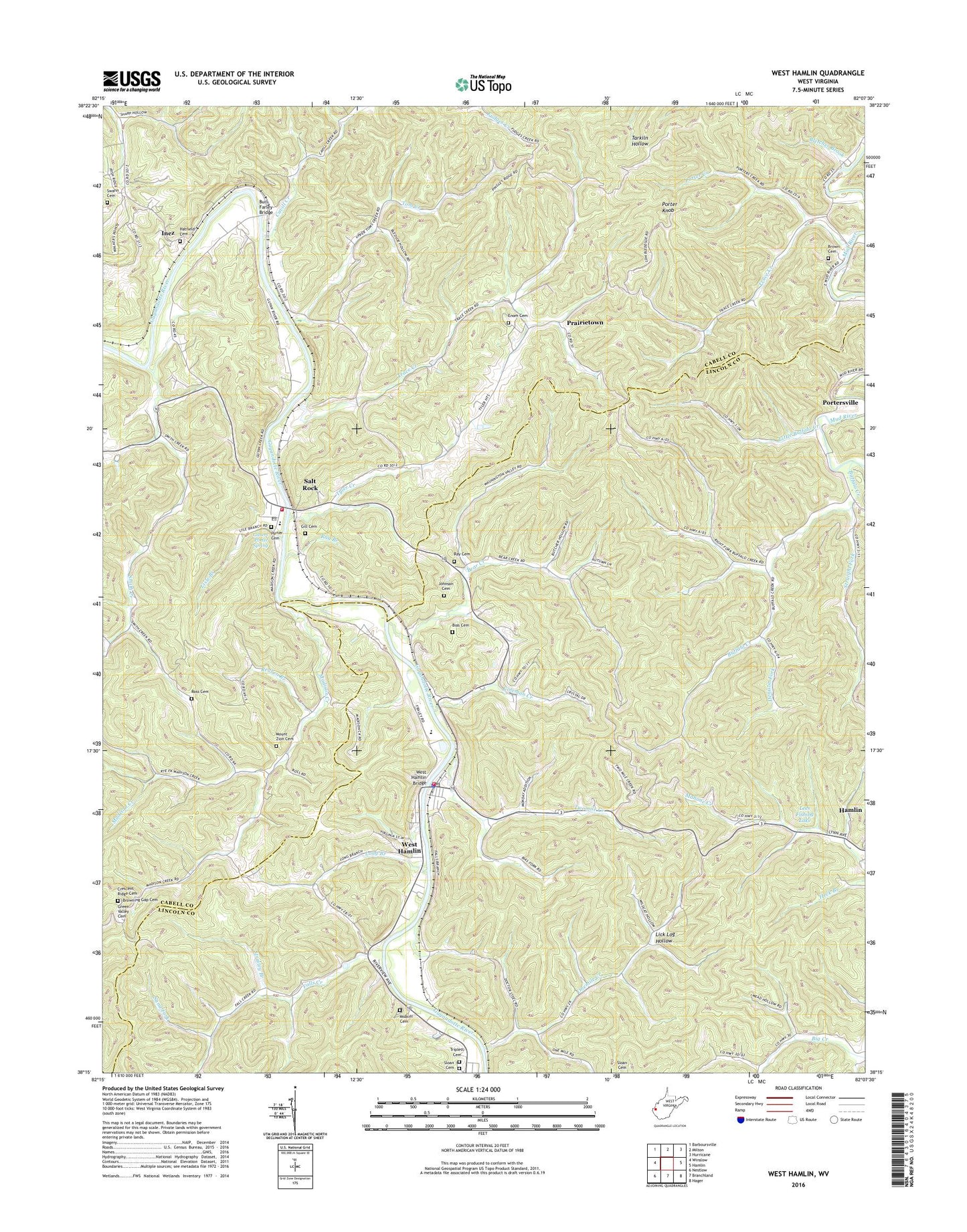
2023 topographic map quadrangle West Hamlin in the state of West Virginia. Scale: 1:24000. Based on the newly updated USGS 7.5' US Topo map series, this map is in the following counties: Lincoln, Cabell. The map contains contour data, water features, and other items you are used to seeing on USGS maps, but also has updated roads and other features. This is the next generation of topographic maps. Printed on high-quality waterproof paper with UV fade-resistant inks.
Quads adjacent to this one:
West: Winslow
Northwest: Barboursville
North: Milton
Northeast: Hurricane
East: Hamlin
Southeast: Hager
South: Branchland
Southwest: Nestlow
This map covers the same area as the classic USGS quad with code o38082c2.
Contains the following named places: Balls Gap, Balls Gap School, Bear Creek, Bear Creek Church, Bias Cemetery, Bletcher Brook, Brown Cemetery, Browning Gap Cemetery, Buffalo Church, Buffalo Creek, Burl Farley Bridge, Cavill Creek, Childers School, Coleman Creek, Collins School, Crescent Ridge Cemetery, Curry Chapel, Dan Bias School, Denison Fork, Enom Cemetery, Enom Church, Falls Creek, Friendly United Church, Gilbert Porter Spring, Gill Cemetery, Green Valley Cemetery, Greenville Church, Hatfield Cemetery, Inez, Johnson Cemetery, Lees Fishing Lake, Lees Fishing Lake Dam, Lick Log Hollow, Lisle Branch, Little Buffalo Creek, Long Branch, Lower Big Creek School, Madison Creek, Midkiff Cemetery, Mount Moriah Church, Mount Zion Cemetery, Mount Zion Church, Onemile Creek, Ousleys Gap School, Pisgah Church, Porter Cemetery, Porter Creek, Porter Knob, Portersville, Prairietown, Ray Branch, Ray Cemetery, Reuben Branch, Roach, Ross Cemetery, Salt Rock, Salt Rock Census Designated Place, Salt Rock Church, Salt Rock Elementary School, Salt Rock Post Office, Salt Rock Public Library, Salt Rock Volunteer Fire Department, Sand Fork, Sheridan District, Sloan Cemetery, Smith Creek, Smith Creek School, Straight Fork, Strailey Branch, Susannah Church, Swann Cemetery, Tom Creek, Town of West Hamlin, Trace Creek, Triplett Cemetery, Twomile Creek, Tyler Creek, Upper Madison Church, Webb School, Welcome Home Church, West Hamlin, West Hamlin Bridge, West Hamlin Elementary School, West Hamlin Police Department, West Hamlin Post Office, West Hamlin United Methodist Church, West Hamlin Volunteer Fire Department, ZIP Codes: 25559, 25571