MyTopo
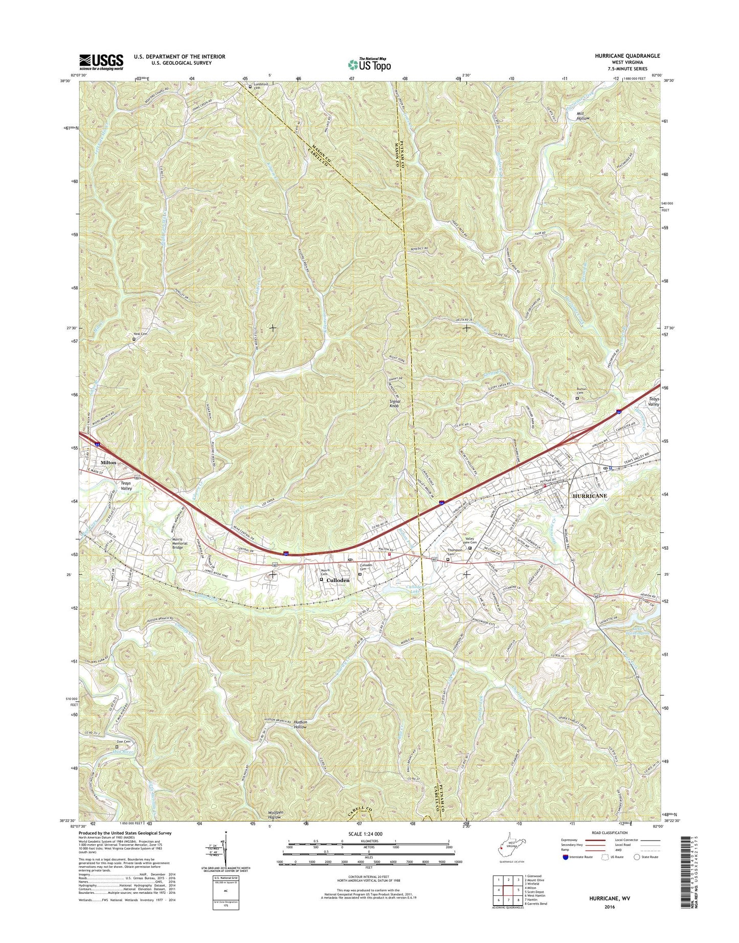
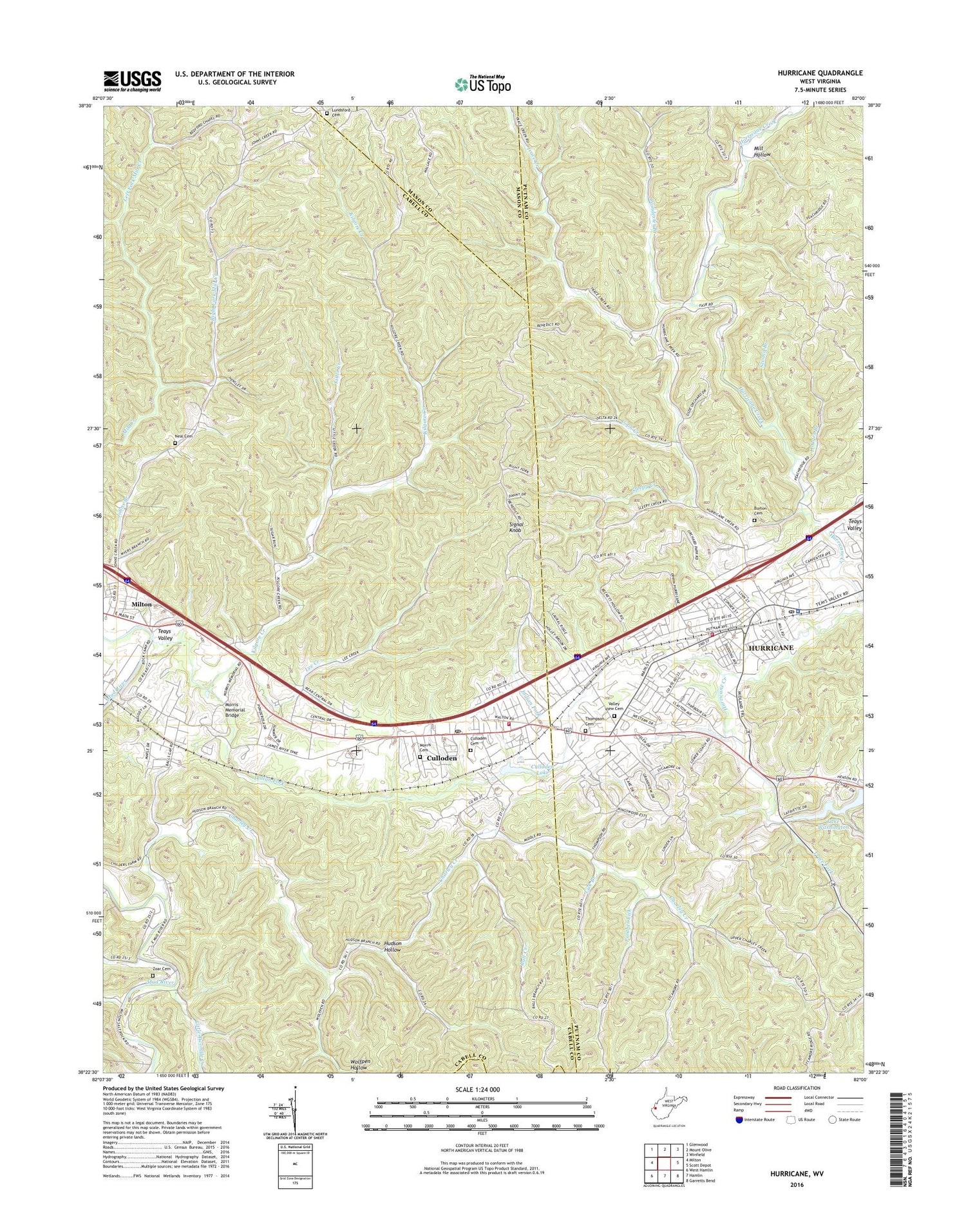
Hurricane West Virginia US Topo Map
Couldn't load pickup availability
2019 topographic map quadrangle Hurricane in the state of West Virginia. Scale: 1:24000. Based on the newly updated USGS 7.5' US Topo map series, this map is in the following counties: Cabell, Putnam, Mason, Lincoln. The map contains contour data, water features, and other items you are used to seeing on USGS maps, but also has updated roads and other features. This is the next generation of topographic maps. Printed on high-quality waterproof paper with UV fade-resistant inks.
Quads adjacent to this one:
West: Milton
Northwest: Glenwood
North: Mount Olive
Northeast: Winfield
East: Scott Depot
Southeast: Garretts Bend
South: Hamlin
Southwest: West Hamlin
Contains the following named places: Ball Creek, Ball Creek Church, Bedford Chapel, Bethany Church, Bethel Church, Big Twomile Creek, Burton Cemetery, Cabell County Emergency Medical Services Station 7, Charley Creek, Charley Creek Church, City of Hurricane, Conner Street Elementary School, Coon Creek, Culloden, Culloden Cemetery, Culloden Census Designated Place, Culloden Elementary School, Culloden Lake, Culloden Post Office, Culloden Volunteer Fire Department, Culloden Water Supply Dam, First Baptist Church of Hurricane, First Church of the Nazarene, Forrest Burdette United Methodist Church, Glad Tidings Assembly of God Church, Good Hope Church, Hodges Branch, Hudson Hollow, Hurricane, Hurricane Bridge, Hurricane City Hall, Hurricane Elementary School, Hurricane Evangelical Free Church, Hurricane High School, Hurricane Middle School, Hurricane Plaza Shopping Center, Hurricane Police Department, Hurricane Post Office, Hurricane Public Library, Hurricane Town Elementary School, Hurricane Volunteer Fire Department, Imperial Estates, Indian Fork, Kilgore Creek, Knollview Estates, Lake Washington, Lake Washington Dam, Lakeside Elementary School, Lee Creek, Left Fork Mill Creek, Lick Branch, Lighthouse Christian Academy, Little Creek, Little Twomile Creek, Lundsford Cemetery, Mesa Manor, Mill Creek Wildlife Management Area, Mill Hollow, Morris Cemetery, Morris Memorial Bridge, Mountain State Christian School, Neal Cemetery, Our Savior Bible Center, Panther Lick, Poindexter Branch, Providence Church, Right Fork Mill Creek, Second Branch, Signal Knob, Sleepy Creek, Susanne Church, Teays Valley, Teays Valley Missionary Baptist Church, Thompson Acres, Thompson Cemetery, Thompson Heights, Trace Creek, Trace Fork, Truth and Liberty Christian School, Valley View Cemetery, Westview Estates, Wheeler Ridge, WNST-AM (Milton), Wolfpen Hollow, WVKV-AM (Hurricane), Zoar Cemetery, ZIP Code: 25510