MyTopo
Julian West Virginia US Topo Map
Couldn't load pickup availability
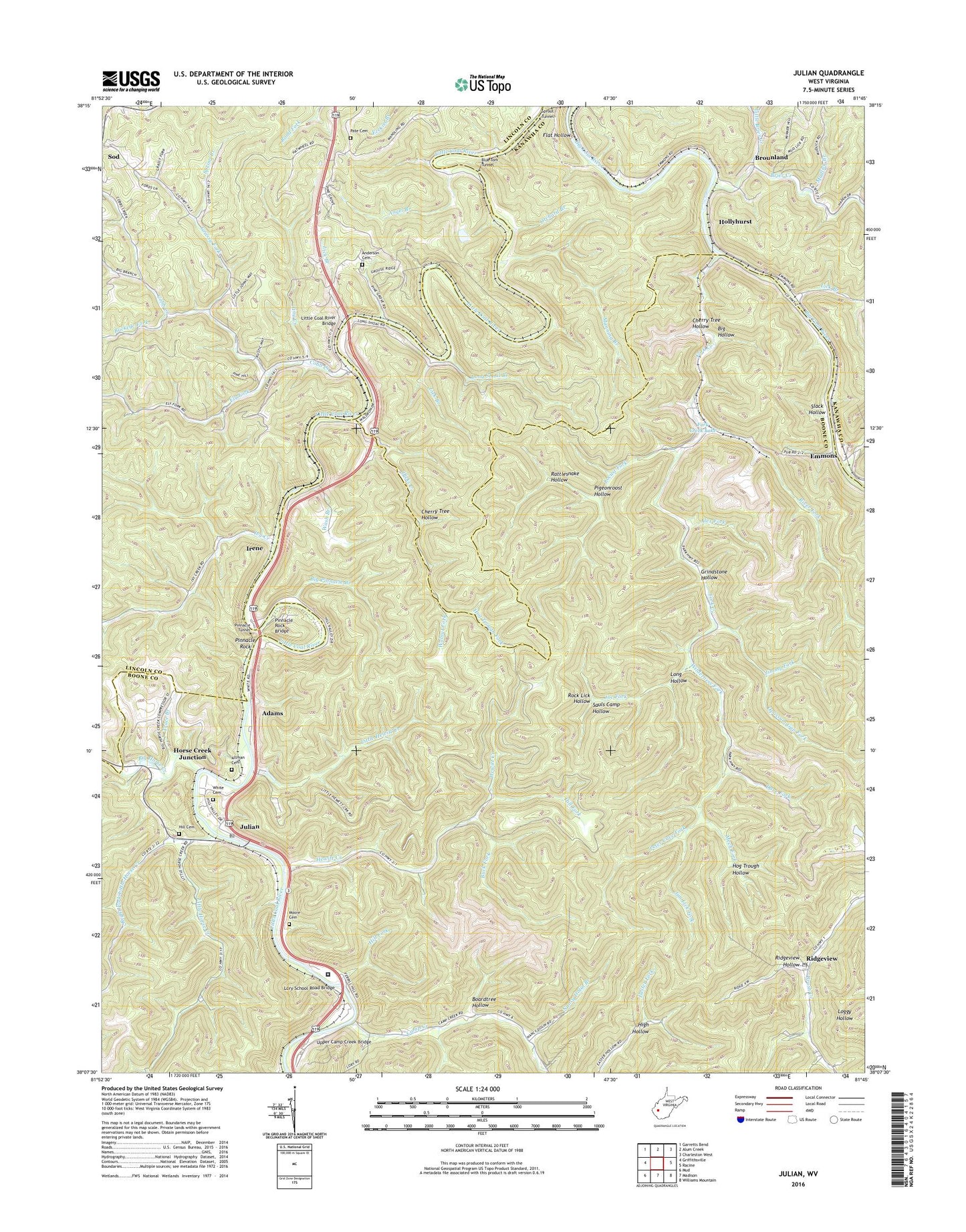
2019 topographic map quadrangle Julian in the state of West Virginia. Scale: 1:24000. Based on the newly updated USGS 7.5' US Topo map series, this map is in the following counties: Boone, Lincoln, Kanawha. The map contains contour data, water features, and other items you are used to seeing on USGS maps, but also has updated roads and other features. This is the next generation of topographic maps. Printed on high-quality waterproof paper with UV fade-resistant inks.
Quads adjacent to this one:
West: Griffithsville
Northwest: Garretts Bend
North: Alum Creek
Northeast: Charleston West
East: Racine
Southeast: Williams Mountain
South: Madison
Southwest: Mud
Contains the following named places: Adams, Alex Fork, Altman, Altman Cemetery, Anderson Cemetery, Angel Branch, Armco Steel Corp Impoundment, Big Hollow, Big Horse Creek, Big Pinnacle Branch, Blue Tom Tunnel, Boardtree Hollow, Brier Creek, Brounland, Brush Creek, Buck Fork, Buckeye Fork, Camp Creek, Cane Branch, Cherry Tree Hollow, Cobb Creek, Dave Fork, Dicks Creek, Donald Kuhn Juvenile Correctional Center, Donald R Kuhn Juvenile Diagnostic and Detention Center, Earl School, Eastep Church, Ely Fork, Emmons, Flat Hollow, Fork Creek, Fork Creek Lake, Fork Creek Public Hunting Area Dam, Fork Creek Wildlife Management Area, Gillespi School, Grassy Fork, Grindstone Hollow, Harless, Hewitt Creek, High Hollow, Hill Cemetery, Hill Fork, Hog Trough Fork, Hog Trough Hollow, Hollyhurst, Horse Creek Junction, Irene, Ivy Creek, Jim Lick Fork, Jimmy Fork, Joe Fork, Julian, Julian Post Office, Lick Branch, Little Brier Creek, Little Coal River Bridge, Little Hewitt Creek, Little Horse Creek, Locust Fork, Long Hollow, Long Shoal Branch, Lory, Lory Church, Lory School, Lory School Road Bridge, Manning Branch, McCorkle, McCorkle Pre-School Center, Mech Fork, Moore Cemetery, Morning Star Church, Mudlick Branch, Nancy Dolin Branch, Opossum Gap, Opossum Gap Fork, Orchard Branch, Pate Cemetery, Peter Cave Fork, Pigeonroost Hollow, Pine Grove Church, Pinnacle Block Church, Pinnacle Rock, Pinnacle Rock Bridge, Pinnacle Tunnel, Rattlesnake Hollow, Ridgeview, Ridgeview Hollow, Ridgeview Post Office, Right Fork Little Horse Creek, River Fork, Rock Lick Hollow, Sarah Church, Sauls Camp Hollow, Slack Hollow, Spring Branch, Sprout Tunnel, Tiny Creek, Trace Branch, Upper Camp Creek Bridge, Walnut Fork, Wash Branch, Washington District, White Cemetery, Wilderness Fork, ZIP Codes: 25169, 25529, 25567