MyTopo
Lerona West Virginia US Topo Map
Couldn't load pickup availability
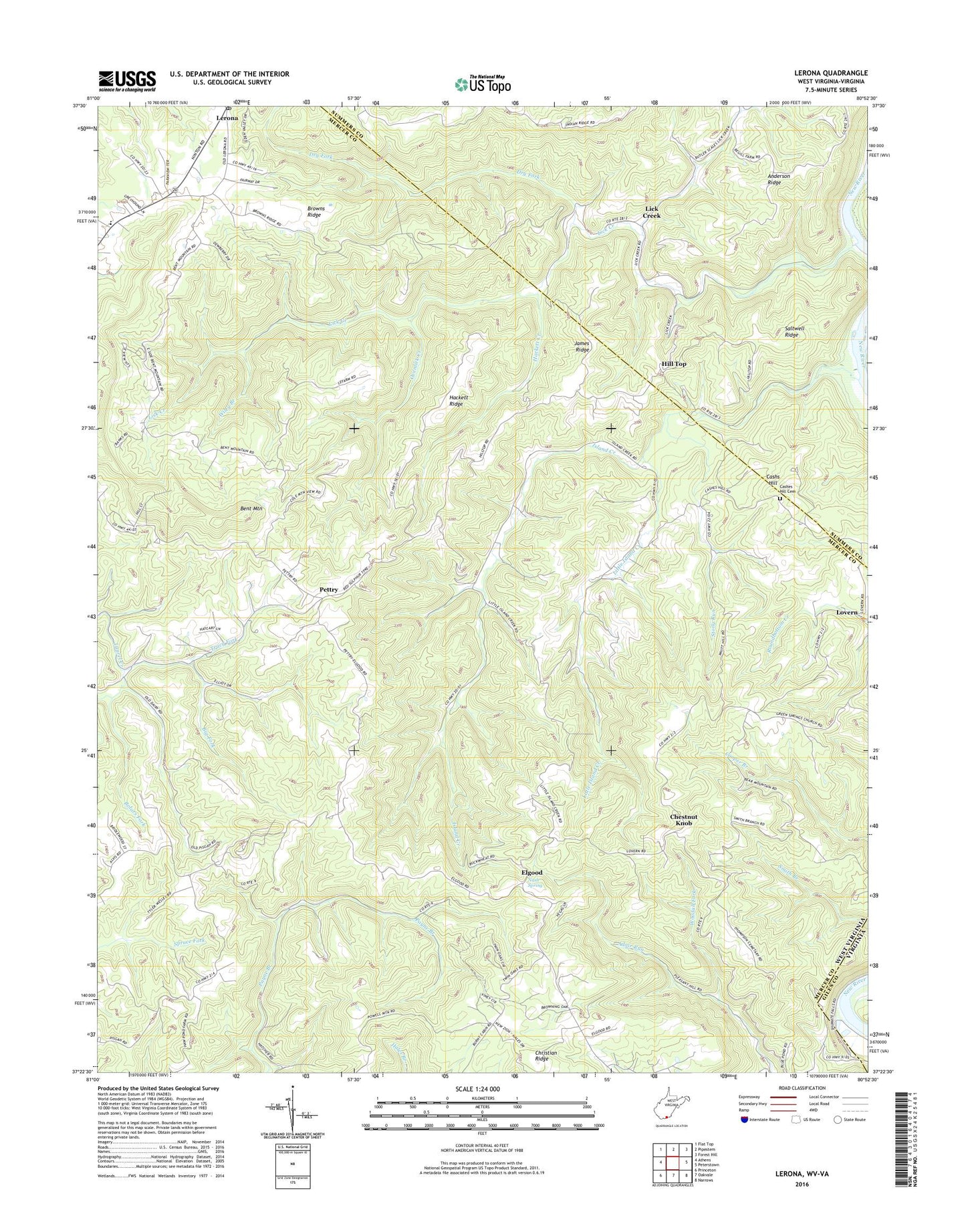
2023 topographic map quadrangle Lerona in the states of West Virginia, Virginia. Scale: 1:24000. Based on the newly updated USGS 7.5' US Topo map series, this map is in the following counties: Mercer, Summers, Giles. The map contains contour data, water features, and other items you are used to seeing on USGS maps, but also has updated roads and other features. This is the next generation of topographic maps. Printed on high-quality waterproof paper with UV fade-resistant inks.
Quads adjacent to this one:
West: Athens
Northwest: Flat Top
North: Pipestem
Northeast: Forest Hill
East: Peterstown
Southeast: Narrows
South: Oakvale
Southwest: Princeton
This map covers the same area as the classic USGS quad with code o37080d8.
Contains the following named places: Anderson Ridge, Bent Mountain, Big Fork, Bird School, Bolars Fork, Browns Chapel, Browns Ridge, Browns Ridge School, Butler School, Caperton School, Cashers Hill, Cashes Hill Cemetery, Cashs Hill, Cashs Hill Church, Chestnut Knob, Chestnut Knob School, Christian Ridge, Dry Fork, Dugspur Rescue Squad, Elgood, Elgood Grade School, Gore School, Green Springs Church, Green Springs School, Greenrock School, Hackett Creek, Hackett Ridge, Hill Top, Hilltop Baptist Church, Island Creek, Island Creek School, James Ridge, Lerona, Lerona Post Office, Lerona-Speedway School, Liberty School, Lick Creek, Lick Creek School, Little Island Creek, Lovern, Martin School, McKenzie School, Mercers Saltworks, Mountain View Community Church, Mudhole School, Nash Spring, Ovenlick Creek, Panther Branch School, Parish Hill School, Pennington School, Pettry, Pettry Post Office, Pleasant Hill School, Saltwell Ridge, Scratchgravel School, Stony Run, Sun Rise Chapel, Sun Valley Elementary School, Thompson Chapel, Tracy Fork, Vest School, Whites Chapel, Whites School, Wiley Branch, Wiley School, Woodall Fork, ZIP Code: 25971