MyTopo
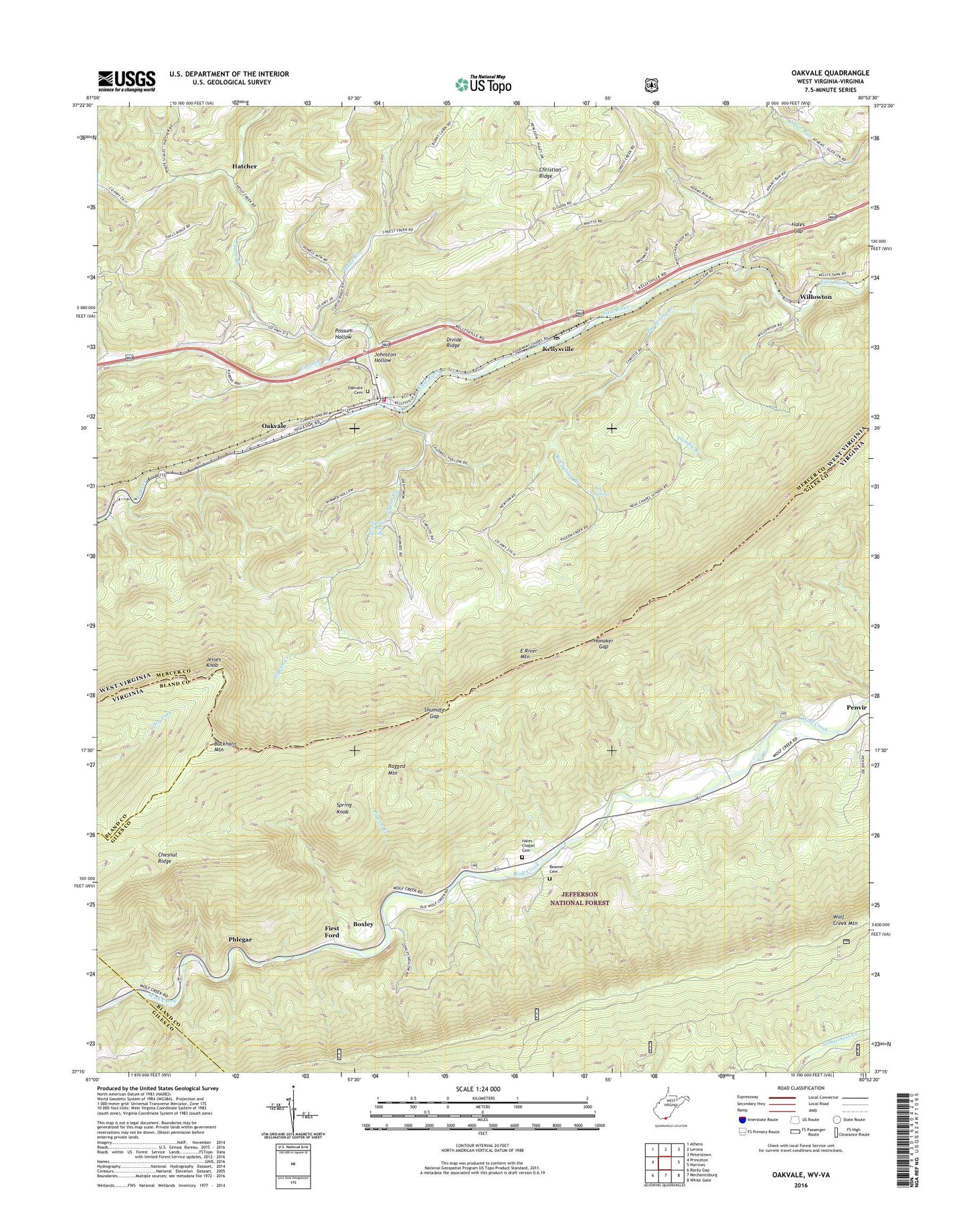
Oakvale West Virginia US Topo Map
Couldn't load pickup availability
Also explore the Oakvale Forest Service Topo of this same quad for updated USFS data
2023 topographic map quadrangle Oakvale in the states of West Virginia, Virginia. Scale: 1:24000. Based on the newly updated USGS 7.5' US Topo map series, this map is in the following counties: Mercer, Giles, Bland. The map contains contour data, water features, and other items you are used to seeing on USGS maps, but also has updated roads and other features. This is the next generation of topographic maps. Printed on high-quality waterproof paper with UV fade-resistant inks.
Quads adjacent to this one:
West: Princeton
Northwest: Athens
North: Lerona
Northeast: Peterstown
East: Narrows
Southeast: White Gate
South: Mechanicsburg
Southwest: Rocky Gap
This map covers the same area as the classic USGS quad with code o37080c8.
Contains the following named places: Adair Run School, Beamer Cemetery, Big Spring, Big Spring Branch, Boxley, Buckhorn Branch, Buckhorn Knob, Buckhorn Mountain, Chapel, Chesnut Ridge, Christian Ridge Church, Day, Divide Ridge, First Ford, Fivemile Creek, Goodwyn Chapel, Hales Branch, Hales Chapel, Hales Chapel Cemetery, Hales Gap, Hales Gap Tunnel, Hatcher, Hatcher Union Church, Honaker Gap, Jesses Knob, Johnston Hollow, Kellysville, Kellysville Post Office, Neel School, New Zion Church, New Zion School, Oakvale, Oakvale Cemetery, Oakvale Church, Oakvale Elementary School, Oakvale School, Oakvale Volunteer Fire Department, Payne Branch, Penvir, Phlegar, Pigeon Branch, Pigeon Creek, Pigeon Creek School, Pigeon Creek Spring, Pleasant Hill Church, Possum Hollow, Possum Hollow School, Ragged Mountain, Shumate Gap, Spring Knob, Stengel, Tate Lohr Wildlife Management Area, Thomas School, Thompson School, Town of Oakvale, Trimble Branch, Willowton, Willowton Christian Church, Wolf Creek Mountain, Wright School