MyTopo
Lost River State Park West Virginia US Topo Map
Couldn't load pickup availability
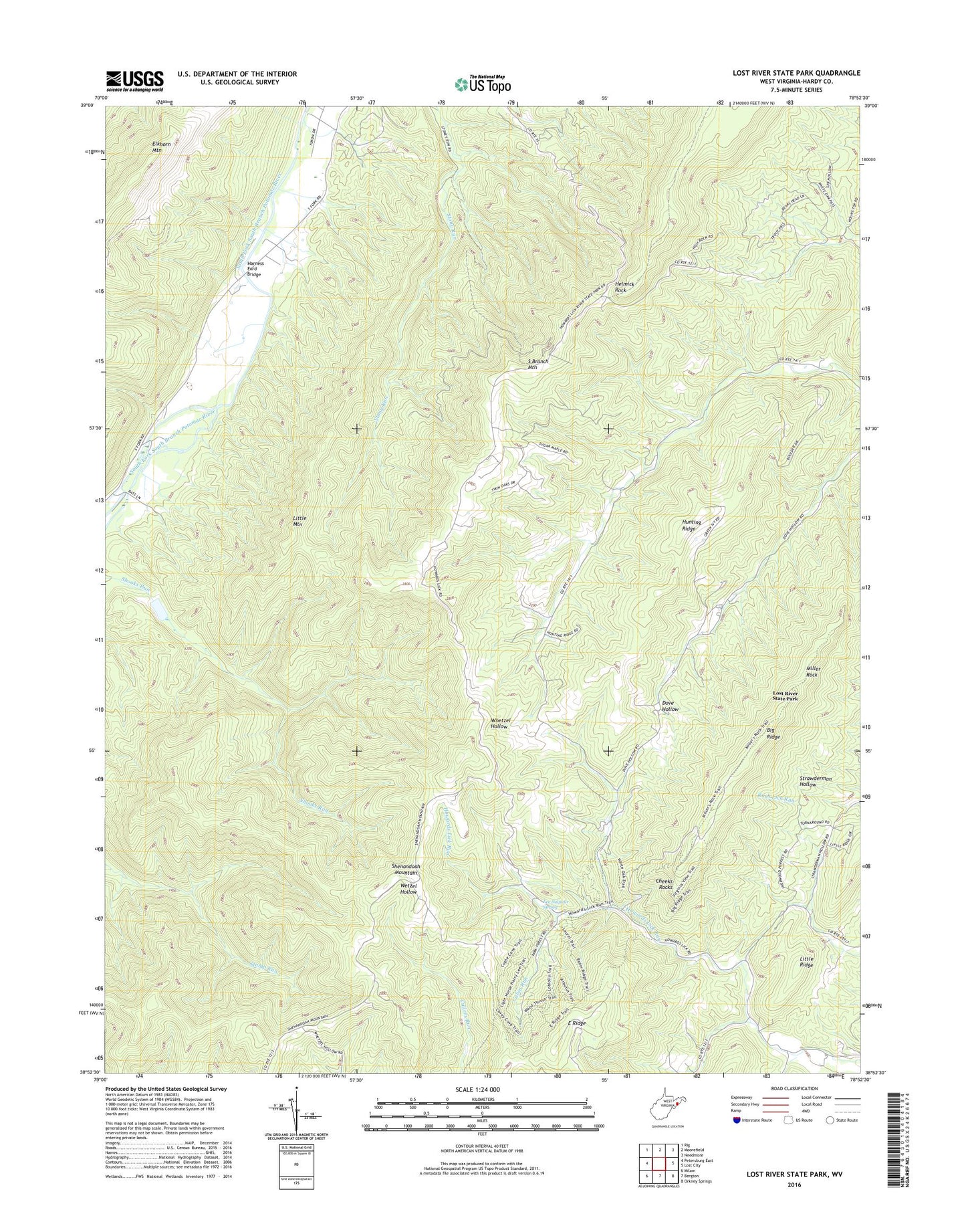
2019 topographic map quadrangle Lost River State Park in the state of West Virginia. Scale: 1:24000. Based on the newly updated USGS 7.5' US Topo map series, this map is in the following counties: Hardy. The map contains contour data, water features, and other items you are used to seeing on USGS maps, but also has updated roads and other features. This is the next generation of topographic maps. Printed on high-quality waterproof paper with UV fade-resistant inks.
Quads adjacent to this one:
West: Petersburg East
Northwest: Rig
North: Moorefield
Northeast: Needmore
East: Lost City
Southeast: Orkney Springs
Southwest: Milam
Contains the following named places: Big Ridge Lookout Tower, Buckhorn Church, Cabin Run, Cheeks Rocks, Cranny Crow Overlook, East Ridge, Harness Ford Bridge, Helmick Rock, Hunting Ridge, Lee Sulphur Spring, Little Mountain, Little Ridge, Lost River State Park, Miller Rock, South Fork Structure One Dam, Strawderman School, Topsy School, Wilkins School, ZIP Codes: 26812, 26836