MyTopo
Moorefield West Virginia US Topo Map
Couldn't load pickup availability
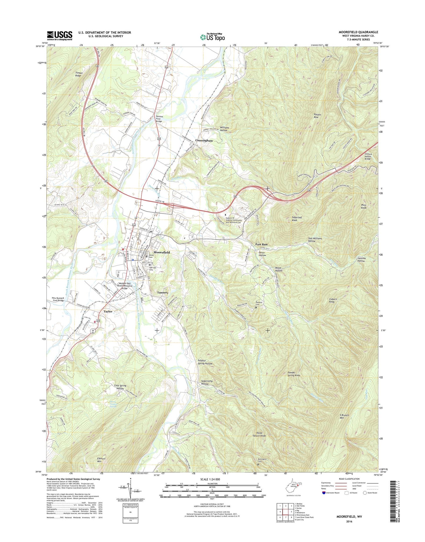
2023 topographic map quadrangle Moorefield in the state of West Virginia. Scale: 1:24000. Based on the newly updated USGS 7.5' US Topo map series, this map is in the following counties: Hardy. The map contains contour data, water features, and other items you are used to seeing on USGS maps, but also has updated roads and other features. This is the next generation of topographic maps. Printed on high-quality waterproof paper with UV fade-resistant inks.
Quads adjacent to this one:
West: Rig
Northwest: Medley
North: Old Fields
Northeast: Sector
East: Needmore
Southeast: Lost City
South: Lost River State Park
Southwest: Petersburg East
This map covers the same area as the classic USGS quad with code o39078a8.
Contains the following named places: Baldwin Cemetery, Burlington Cemetery, Clifford Hollow Bridge, Coburn Knob, Cunningham, Dover Hollow, Dover School, Dumpling Run, Fort Run, Fort Run Church, Fraley Ambulance Service, Hardy County Courthouse, Hardy County Public Library, Hardy County Sheriff's Office, Harpers Chapel, Harry Veeders Spring, Hutton Run, Jemima Hollow, Mapleton, Meadow, Moorefield, Moorefield District, Moorefield Elementary School, Moorefield High School, Moorefield Historic District, Moorefield Intermediate School, Moorefield Middle School, Moorefield Police Department, Moorefield Post Office, Moorefield Volunteer Fire Department, New Buzzard Ford Bridge, Oak Hill Cemetery, Olivet Cemetery, Parren School, Parsons Ford Bridge, Phils Knob, Potato Row, Potter Run School, Powder Spring Knob, Sawmill Run, South Branch Cinema 6, South Fork South Branch Potomac River, Stony Run, Sugarcamp Hollow, Sugarloaf Knob, Sulphur Spring Hollow, Tannery, Tannery Presbyterian Church, Taylor, Three Square Knob, Timber Ridge, Tom Williams Hollow, Town of Moorefield, Wendell Dell Hester Memorial Bridge, West Virginia Division of Forestry Hardy County Field Office, Williams Hollow, Wood Hollow


