MyTopo
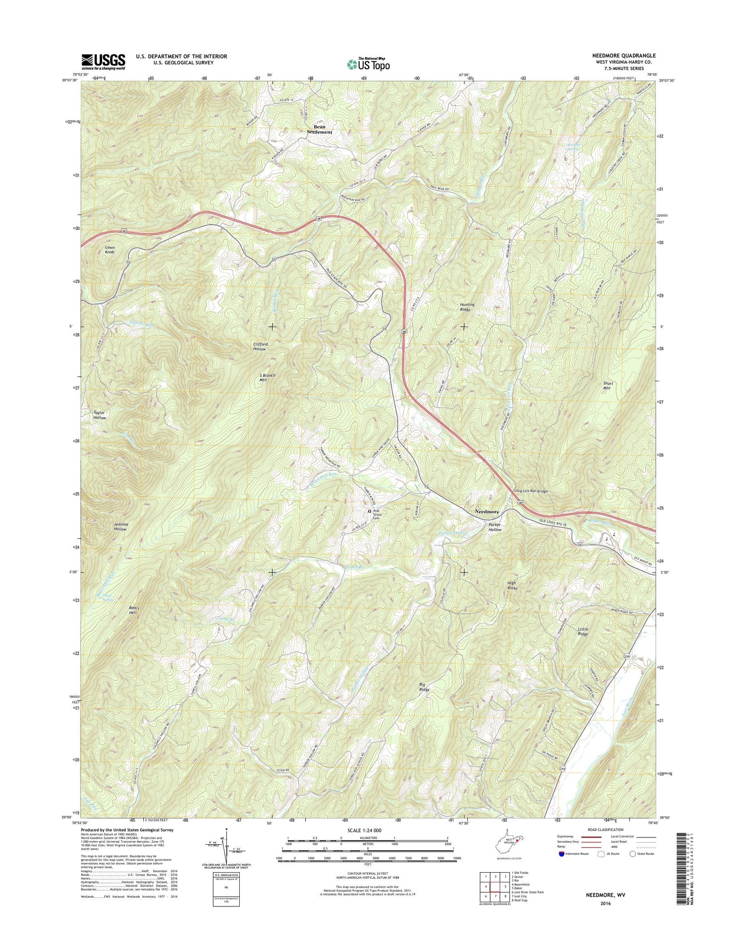
Needmore West Virginia US Topo Map
Couldn't load pickup availability
Also explore the Needmore Forest Service Topo of this same quad for updated USFS data
2023 topographic map quadrangle Needmore in the state of West Virginia. Scale: 1:24000. Based on the newly updated USGS 7.5' US Topo map series, this map is in the following counties: Hardy. The map contains contour data, water features, and other items you are used to seeing on USGS maps, but also has updated roads and other features. This is the next generation of topographic maps. Printed on high-quality waterproof paper with UV fade-resistant inks.
Quads adjacent to this one:
West: Moorefield
Northwest: Old Fields
North: Sector
Northeast: Rio
East: Baker
Southeast: Wolf Gap
South: Lost City
Southwest: Lost River State Park
This map covers the same area as the classic USGS quad with code o39078a7.
Contains the following named places: Asbury Church, Baker Church, Baker Run School, Bean Settlement, Bears Hell, Bears Hell Run, Camp Branch, Camp Branch School, Chestnut Cove School, Doman, East Hardy Early Middle School, East Hardy High School, East Hardy Public Library, Evergreen Church, Fabius, Hardy County, High Rocks, Hines School, Hunting Ridge, Lawn Knob, Long Lick Run, Long Lick Run Bridge, Long Lick School, Luxemburg School, Miller School, Mine Spring School, Needmore, Parker Hollow, Phils Lick School, Pine Grove Cemetery, Pine Grove Church, Reynolds School, Salem Church, Sand Spring, Swartz Run, Taylor Hollow, Webster Spring, ZIP Code: 26801