MyTopo
Mount Storm Lake West Virginia US Topo Map
Couldn't load pickup availability
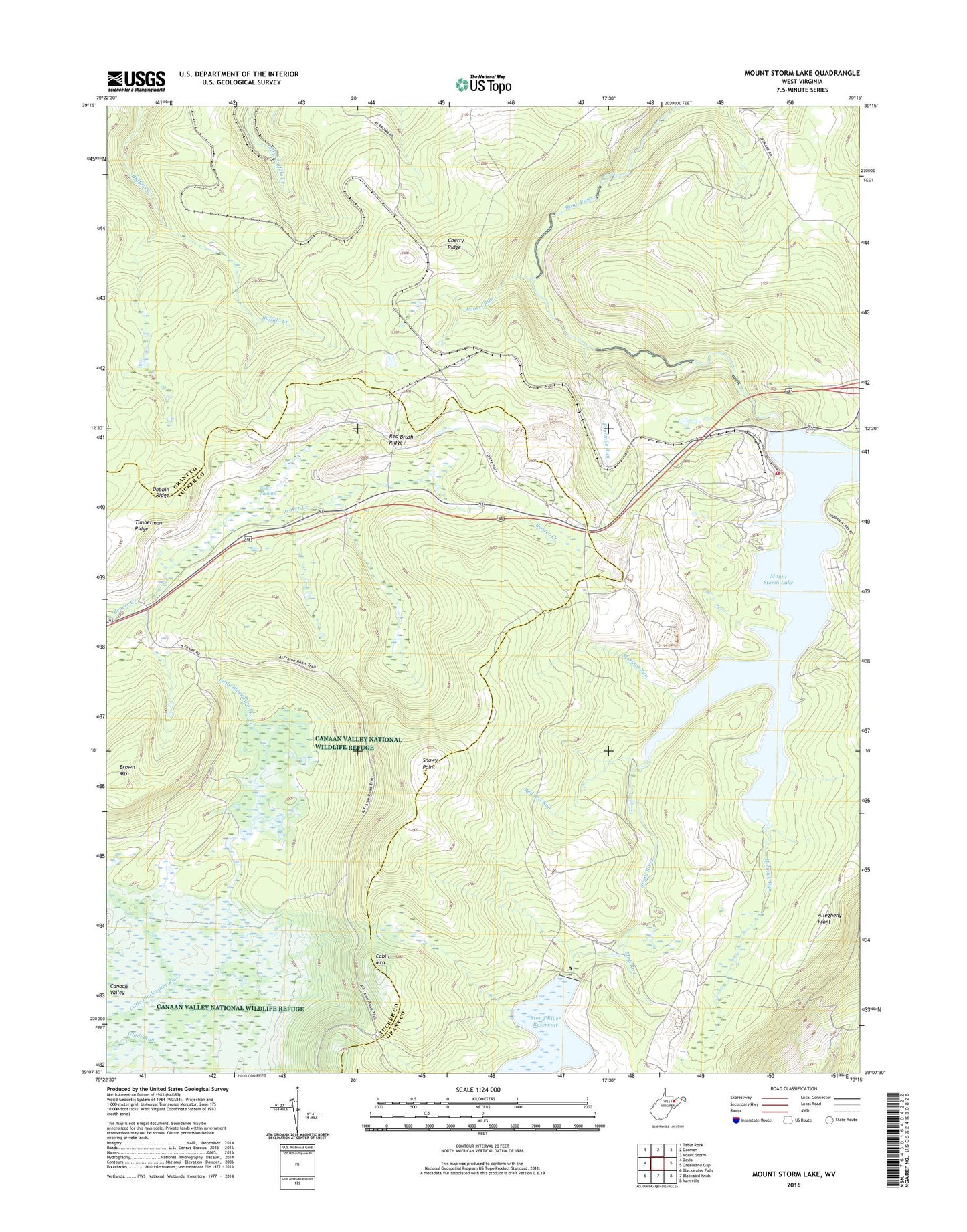
2019 topographic map quadrangle Mount Storm Lake in the state of West Virginia. Scale: 1:24000. Based on the newly updated USGS 7.5' US Topo map series, this map is in the following counties: Grant, Tucker. The map contains contour data, water features, and other items you are used to seeing on USGS maps, but also has updated roads and other features. This is the next generation of topographic maps. Printed on high-quality waterproof paper with UV fade-resistant inks.
Quads adjacent to this one:
West: Davis
Northwest: Table Rock
North: Gorman
Northeast: Mount Storm
East: Greenland Gap
Southeast: Maysville
South: Blackbird Knob
Southwest: Blackwater Falls
Contains the following named places: Accident School, Brown Mountain, Camp 94, Camp Seventytwo, Canaan Valley, Cherry Ridge, Dobbin Ridge, Elder Swamp, Fourmile Run, Helmick Run, Ice House Rocks, Laurel Run, Morgan Run, Mount Storm Lake, Mount Storm Power Station, Mount Storm Power Station Fire Department and Rescue, Mud Run, Red Brush Ridge, Red Sea Run, Snowy Point, Stony River Dam, Stony River Reservoir, Timberman Ridge, Union District