MyTopo
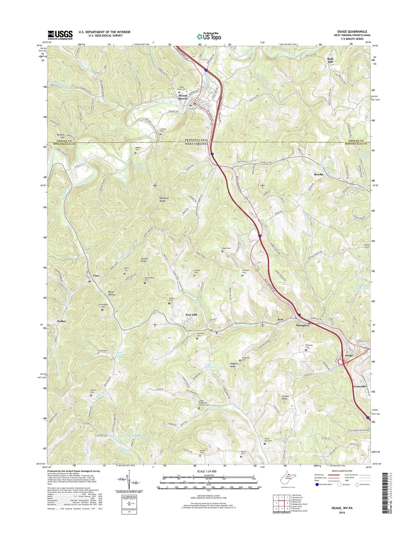
Osage West Virginia US Topo Map
Couldn't load pickup availability
2023 topographic map quadrangle Osage in the states of West Virginia, Pennsylvania. Scale: 1:24000. Based on the newly updated USGS 7.5' US Topo map series, this map is in the following counties: Monongalia, Greene. The map contains contour data, water features, and other items you are used to seeing on USGS maps, but also has updated roads and other features. This is the next generation of topographic maps. Printed on high-quality waterproof paper with UV fade-resistant inks.
Quads adjacent to this one:
West: Blacksville
Northwest: Oak Forest
North: Garards Fort
Northeast: Masontown
East: Morgantown North
Southeast: Morgantown South
South: Rivesville
Southwest: Grant Town
This map covers the same area as the classic USGS quad with code o39080f1.
Contains the following named places: Alternative Learning Center, Arkwright-Sears Amd Pond, Bacon Run, Bailey A M D Treatment Facility Dam, Bald Hill, Bald Hill Cemetery, Bald Hill Church, Barrackman Cemetery, Berry Cemetery, Berry Hollow, Bethel United Methodist Church, Bowlby, Bradford Cemetery, Brand Cemetery, Brewster Cemetery, Browns Hill, Calvin Run, Cass District Junior High School, Cass Elementary School, Cassville, Cassville - Scotts Run Volunteer Fire Department, Cassville Census Designated Place, Cassville Junior High School, Cassville Post Office, Cedar Grove Cemetery, Chaplin, Chisler Knob, Clarence Fetty Spring, Core, Core Elementary School, Core Post Office, Cunningham Cemetery, Dents Run Cemetery, Dolls Run, Dolls Run Christian Church, Dooley Run, Dunkard Methodist Protestant Church, Dunkard Ridge, Fairchance, Fleming Cemetery, Fox Run, Frank O'Brad Spring, Greeley School, Guston Run, Higgins Knob, Hobbs Run, Hollywood - Stadium 12, Holman, House of Refuge Power in Praise Ministries, Jere, John Petrovich Spring, Lemley Cemetery, Liming Cemetery, Little Shannon Run, Lough - Teagarden - Cordray Cemetery, Meadow Ponds Golf and Country Club, Meyers Cemetery, Monongalia County, Morris Cemetery, Mount Morris, Mount Morris Cemetery, Mount Morris Census Designated Place, Mount Morris Community Volunteer Fire Department Company 18, Mount Morris Emergency Medical Services, Mount Morris Post Office, Mountaineer Golf and Country Club, Mylan Park Elementary School, New Hill, Osage, Osage Census Designated Place, Pedlar, Pedlar Run, Pleasant Valley United Methodist Church, Pursglove, Pursglove Post Office, Pursglove Presbyterian Church, Ralph Tennant Spring, Ripleys Run, Scottdale School, Scotts Run, Scotts Run Refuse Dam, Shannon Run, Shannon Run Church, Simpson Cemetery, Smoky Drain, Snider Cemetery, Stan McElroy Spring, Sugar Grove Presbyterian Church, Sutton Cemetery, Sutton Knob, University Towne Center, Wade Cemetery, Wade Spring, Wades Run, WAJR-AM (Morgantown), Watkins Run, Zoar Church, ZIP Codes: 26501, 26534