MyTopo
Petersburg West West Virginia US Topo Map
Couldn't load pickup availability
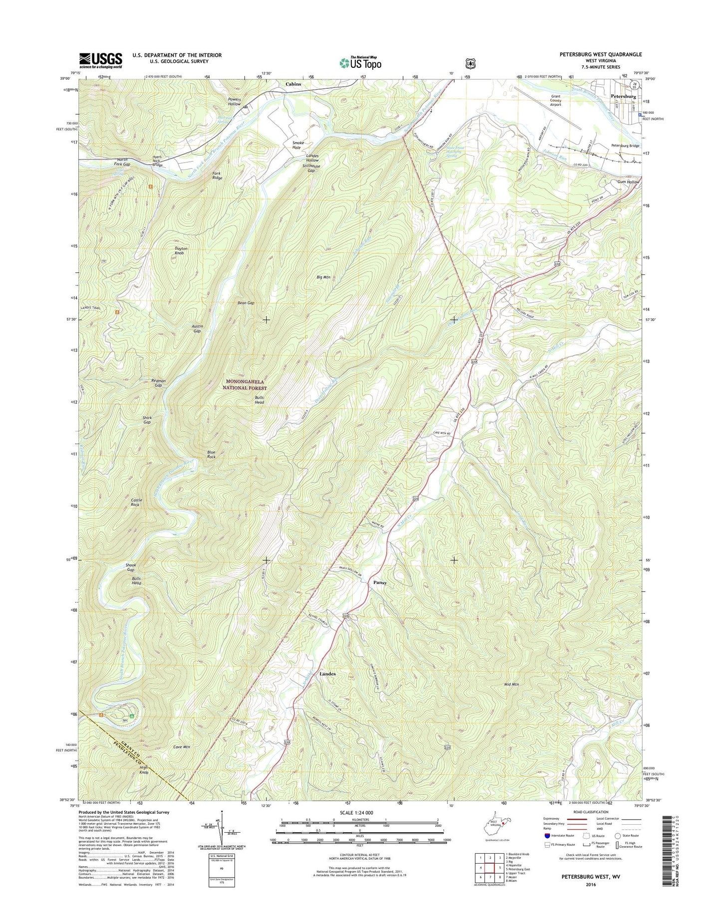
2019 topographic map quadrangle Petersburg West in the state of West Virginia. Scale: 1:24000. Based on the newly updated USGS 7.5' US Topo map series, this map is in the following counties: Grant, Pendleton. The map contains contour data, water features, and other items you are used to seeing on USGS maps, but also has updated roads and other features. This is the next generation of topographic maps. Printed on high-quality waterproof paper with UV fade-resistant inks.
Quads adjacent to this one:
West: Hopeville
Northwest: Blackbird Knob
North: Maysville
Northeast: Rig
East: Petersburg East
Southeast: Milam
South: Mozer
Southwest: Upper Tract
Contains the following named places: Austin Gap, Bean Gap, Believers Mennonite Faith Christian School, Bethel Church, Big Bend Campground, Big Mountain, Blue Rock, Bulls Head, Cabin Schoolhouse, Cabins, Cabins Post Office, Camp Echo, Castle Rock, City of Petersburg, Cold Spring, Dayton Knob, Deep Hollow Run, Edgewood School, Fairview School, Fork Ridge, Gordon Chapel, Grant County Airport, Harmony School, High Knob, Hyers Rock Bridge, Ketterman School, Landes, Landes Hollow, Long Run, Loop Trail, Marvin Chapel, Milroy District, Moomau-Grant County Public Library, Mount Hope School, Mountaindale School, North Fork Christian School, North Fork Gap, North Fork Mountain Trail, North Fork South Branch Potomac River, North Mill Creek Church, Pansy, Petersburg Fish Hatchery, Petersburg Police Department, Poor Farm Spring, Powers Hollow, Redman Gap, Redman Run, Royal Glen Mill, Royal Glen School, Saint Johns Church, Sawmill Branch, Shirk Gap, Shoock School, Shook Gap, Sites School, Smoke Hole, State Trout Hatchery Spring, Stillhouse Gap, ZIP Code: 26847