MyTopo
Rio West Virginia US Topo Map
Couldn't load pickup availability
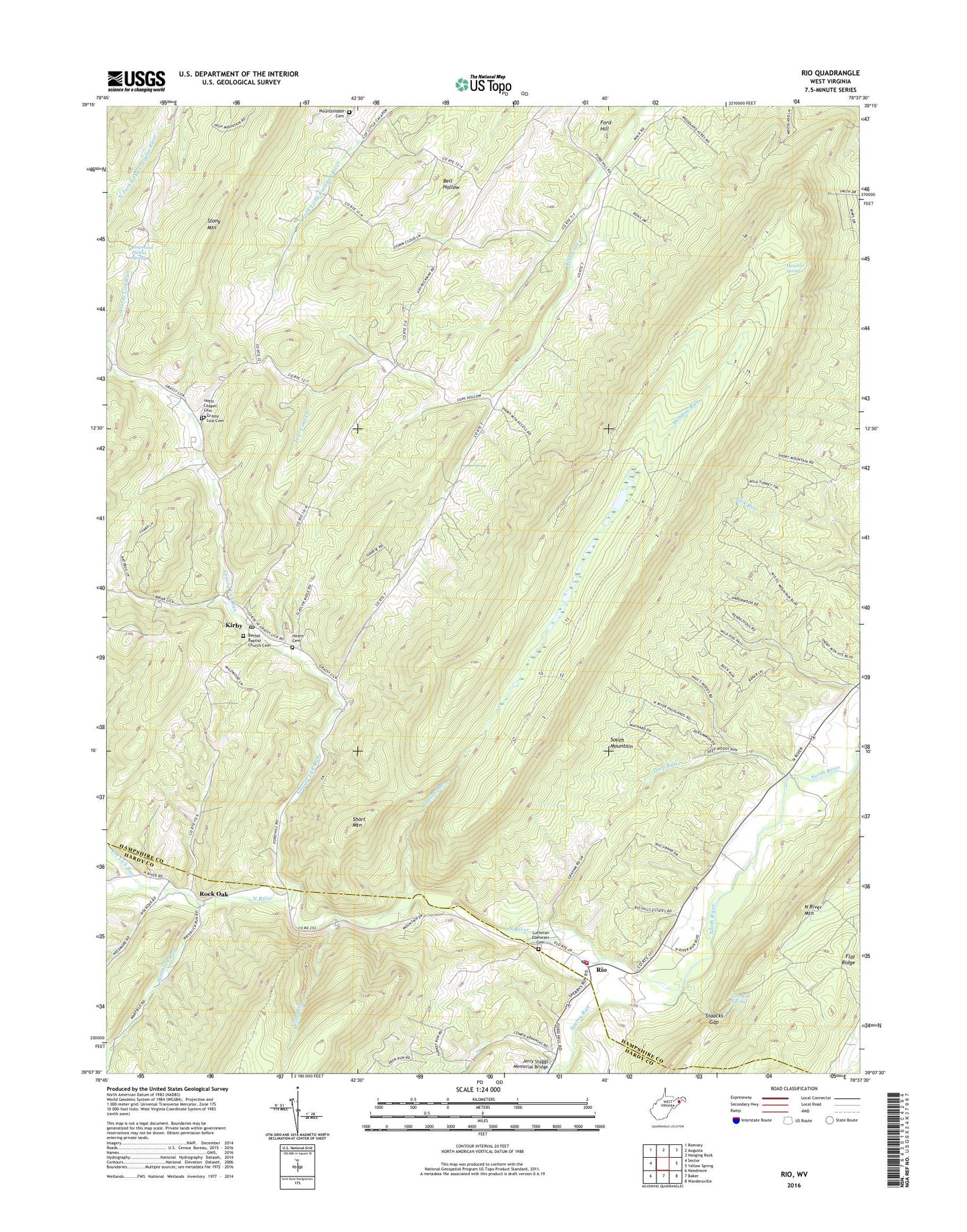
2019 topographic map quadrangle Rio in the state of West Virginia. Scale: 1:24000. Based on the newly updated USGS 7.5' US Topo map series, this map is in the following counties: Hampshire, Hardy. The map contains contour data, water features, and other items you are used to seeing on USGS maps, but also has updated roads and other features. This is the next generation of topographic maps. Printed on high-quality waterproof paper with UV fade-resistant inks.
Quads adjacent to this one:
West: Sector
Northwest: Romney
North: Augusta
Northeast: Hanging Rock
East: Yellow Spring
Southeast: Wardensville
South: Baker
Southwest: Needmore
Contains the following named places: Bethel Baptist Church Cemetery, Bethel Schoolhouse, Cove Run, Deep Run, Deep Run School, Denver School, Flat Ridge, Ford Hill, Gap Run Spring, Grassy Lick Cemetery, Grassy Lick Elementary School, Grassy Lick Run, Heare Cemetery, Hotts Chapel, Hotts Chapel Cemetery, Jerry Staggs Memorial Bridge, Kirby, Kirby Bethel Baptist Church, Kirby Post Office, Lutheran Ebenezer Cemetery, Marshall School, Meadow Run, Meadow Spring, Mount Zion Church, Mountaindale Cemetery, Mountaindale Church, North River Valley Volunteer Fire Company, Pot Lick Run, Raymond Hawse Spring, Rio, Rio Elementary School, Rio Post Office, Rock Oak, Ruckman, Sherman District, Short Mountain Wildlife Management Area, Sperry Run, Staacks Gap, Sugar Grove School, Waterlick Run, Watson School, Zoar Church, ZIP Codes: 26714, 26755