MyTopo
Winslow West Virginia US Topo Map
Couldn't load pickup availability
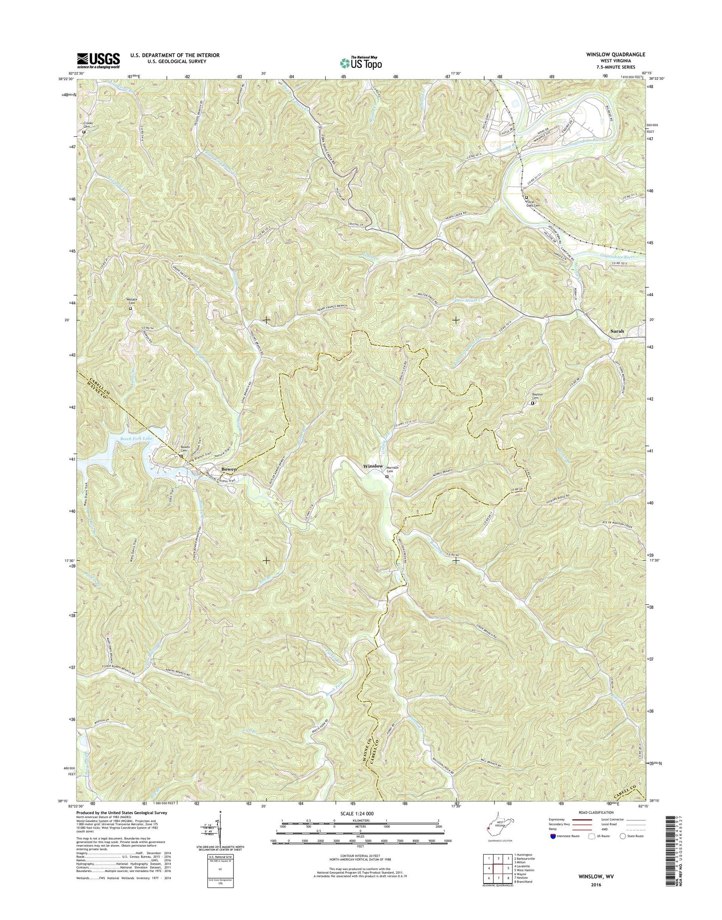
2023 topographic map quadrangle Winslow in the state of West Virginia. Scale: 1:24000. Based on the newly updated USGS 7.5' US Topo map series, this map is in the following counties: Cabell, Wayne, Lincoln. The map contains contour data, water features, and other items you are used to seeing on USGS maps, but also has updated roads and other features. This is the next generation of topographic maps. Printed on high-quality waterproof paper with UV fade-resistant inks.
Quads adjacent to this one:
West: Lavalette
Northwest: Huntington
North: Barboursville
Northeast: Milton
East: West Hamlin
Southeast: Branchland
South: Nestlow
Southwest: Wayne
This map covers the same area as the classic USGS quad with code o38082c3.
Contains the following named places: Bartram, Baylous Cemetery, Beech Fork State Park, Bloomingdale Church, Bowen, Bowen Cemetery, Bowen Creek, Bowen Ridge Church, Butler Branch, Cabell County Emergency Medical Services Station 5, Cabell Lookout Tower, Camp Asbury, Camp Branch, Camp Dekanawida, Crooks Cemetery, Davis Chapel, District 4, Floral Oaks Cemetery, Grassy Lick, Green Valley Chapel, Heath Creek, Jim Branch, Johnson, Lick Branch, Long Branch, Lower Tom Creek, Lyons Branch, Macedonia Church, Mays Chapel, McComas School, Merritt Creek, Merritt Creek Church, Morrison Cemetery, Moxley Branch, Owens Crossing, Parker Branch, Raccoon Creek, Right Fork Merritt Creek, Salem Church, Sarah, Swamp Branch, The Esquire Country Club Golf Course, Upper Heath Creek, Wallace Cemetery, Winslow