MyTopo
Almena Wisconsin US Topo Map
Couldn't load pickup availability
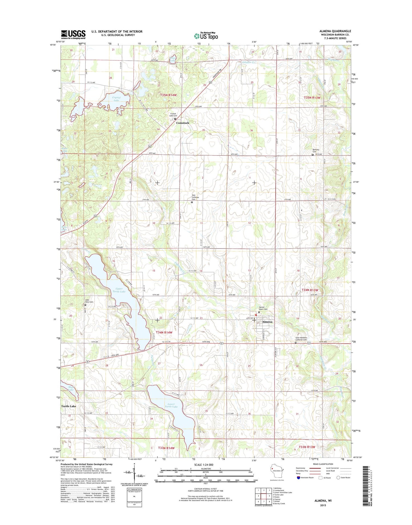
2022 topographic map quadrangle Almena in the state of Wisconsin. Scale: 1:24000. Based on the newly updated USGS 7.5' US Topo map series, this map is in the following counties: Barron. The map contains contour data, water features, and other items you are used to seeing on USGS maps, but also has updated roads and other features. This is the next generation of topographic maps. Printed on high-quality waterproof paper with UV fade-resistant inks.
Quads adjacent to this one:
West: Turtle Lake
Northwest: McKinley
North: Cumberland
Northeast: Lower Vermillion Lake
East: Poskin
Southeast: Dorrity Creek
South: Arland
Southwest: Clayton
Contains the following named places: Almena, Almena Clinton Arland Fire District, Almena Elementary School, Almena Post Office, Backroad Dairy, Bethany Cemetery, Bethany Church, Bethany Valley Farms, Castelle Farm, Clinton Heights School, Comstock, Comstock Post Office, Corey School, Crystal Lake, Crystal Lake Cemetery, Finley School, Gates Lake, Gospel Mennonite School, Hay River Valley School, Johnson Creek, Lake View Cemetery, Lightning Creek, Lightning Creek State Wildlife Area, Lower Turtle Lake, Maple Grove School, Midway School, Mud Lake, Perley Church, Sacred Heart Cemetery, Sacred Heart of Jesus Church, Saint Matthew Lutheran Cemetery, Saint Matthew Lutheran Church, Sprague School, Town of Almena, Upper Turtle Lake, Village of Almena, Zion Lutheran Cemetery, Zion Lutheran Church, ZIP Code: 54805