MyTopo
New Hope Wisconsin US Topo Map
Couldn't load pickup availability
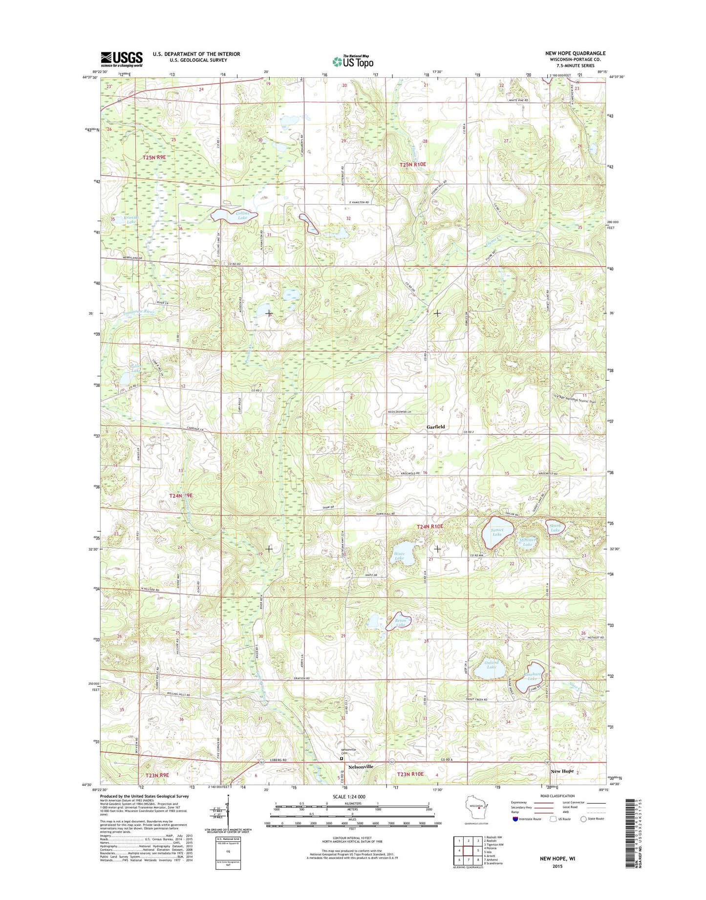
2022 topographic map quadrangle New Hope in the state of Wisconsin. Scale: 1:24000. Based on the newly updated USGS 7.5' US Topo map series, this map is in the following counties: Portage. The map contains contour data, water features, and other items you are used to seeing on USGS maps, but also has updated roads and other features. This is the next generation of topographic maps. Printed on high-quality waterproof paper with UV fade-resistant inks.
Quads adjacent to this one:
West: Polonia
Northwest: Rosholt NW
North: Rosholt
Northeast: Tigerton NW
East: Iola
Southeast: Scandinavia
South: Amherst
Southwest: Arnott
This map covers the same area as the classic USGS quad with code o44089e3.
Contains the following named places: Chick-A-Gami Bay Scout Camp, Collins Lake, Collins Park, Garfield, Hamilton School, Hintz Lake, Kranski Lake, Malloy School, Minister Lake, Nelsonville Lutheran Cemetery, New Hope, New Hope Pines State Natural Area, North New Hope Church, Oakland School, Onland Lake, Pallen Lake, Poncho Creek, Reton Lake, Rinehart Lake, Rinehart School, Saint Adalbert School, Skunk Lake, South New Hope Church, Sunset Lake, Tomorrow River School, Town of New Hope, ZIP Code: 54407