MyTopo
Dundee Wisconsin US Topo Map
Couldn't load pickup availability
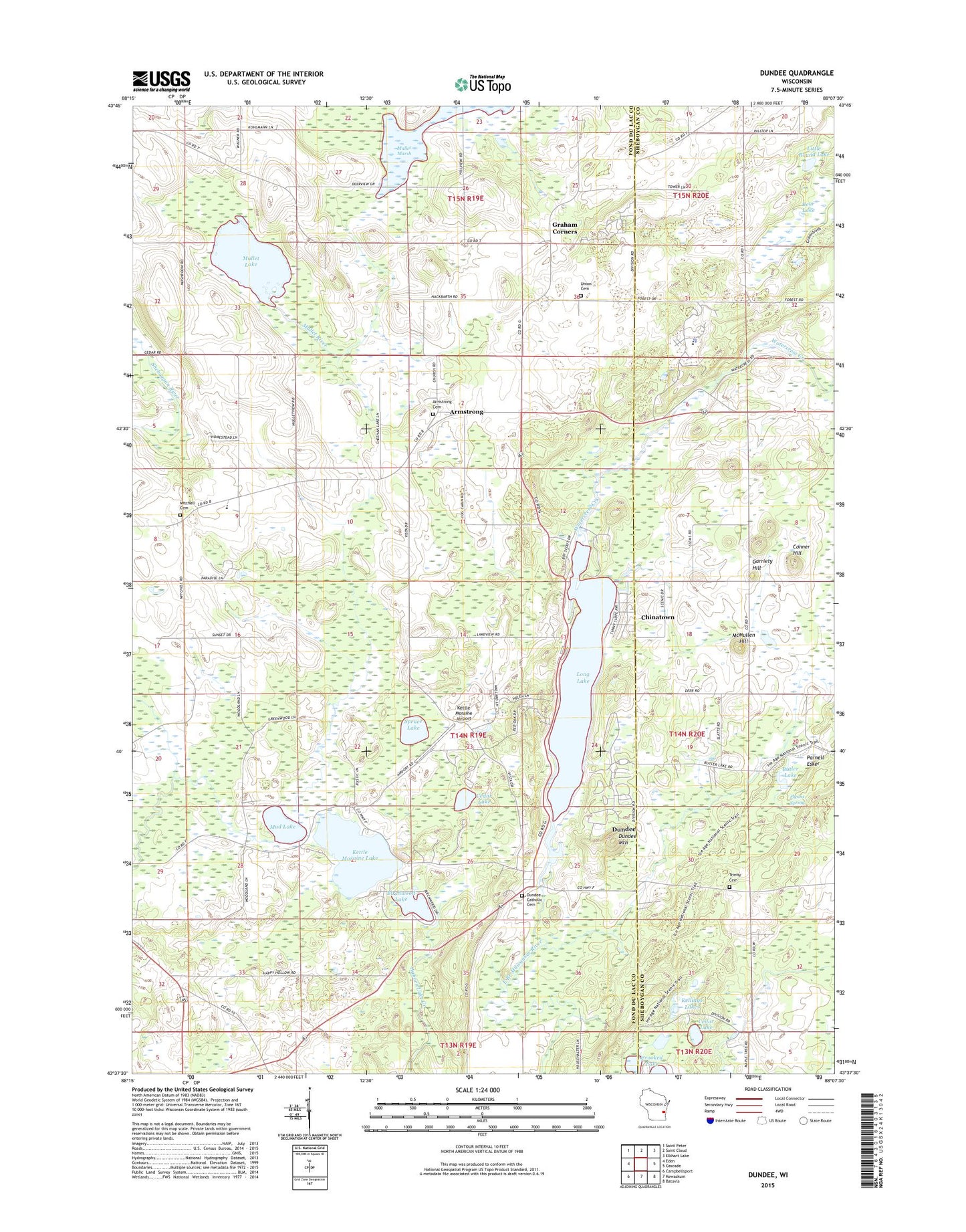
2022 topographic map quadrangle Dundee in the state of Wisconsin. Scale: 1:24000. Based on the newly updated USGS 7.5' US Topo map series, this map is in the following counties: Fond du Lac, Sheboygan. The map contains contour data, water features, and other items you are used to seeing on USGS maps, but also has updated roads and other features. This is the next generation of topographic maps. Printed on high-quality waterproof paper with UV fade-resistant inks.
Quads adjacent to this one:
West: Eden
Northwest: Saint Peter
North: Saint Cloud
Northeast: Elkhart Lake
East: Cascade
Southeast: Batavia
South: Kewaskum
Southwest: Campbellsport
This map covers the same area as the classic USGS quad with code o43088f2.
Contains the following named places: Armstrong, Armstrong Cemetery, Armstrong School, Bear Lake, Birchwood Lake, Butler Lake, Butler Lake and Flynn's Spring State Natural Area, Camp Long Lake, Camp Vista, Cedar Lake, Chinatown, Conner Hill, Crooked Lake Wetlands State Natural Area, Dundee, Dundee Dam, Dundee Mountain, Flynns Spring, Garriety Hill, Graham Corners, Kellings Lakes, Kettle Moraine Airport, Kettle Moraine Correctional Institution, Kettle Moraine Correctional Institution School, Kettle Moraine Lake, Kutz Farm, Little Round Lake, Long Lake, Long Lake Recreation Area, McMullen Hill, Meadow Creek Farm, Milwaukee River Tamarack Lowlands and Dundee Kame State Natural Area, Mitchell Cemetery, Mitchell School, Mud Lake, Mullet Lake, Mullet River State Wildlife Area, Parnell Esker, Pius School, Rainbow Acres, Sacred Heart Cemetery, Shepherd of the Hills School, Spruce Lake, Spruce Lake Bog National Landmark, Spruce Lake Bog State Natural Area, State Road School, Tittle Lake, Town of Osceola, Trinity Cemetery, Union Cemetery, Watercress Creek