MyTopo
Bear Creek Wisconsin US Topo Map
Couldn't load pickup availability
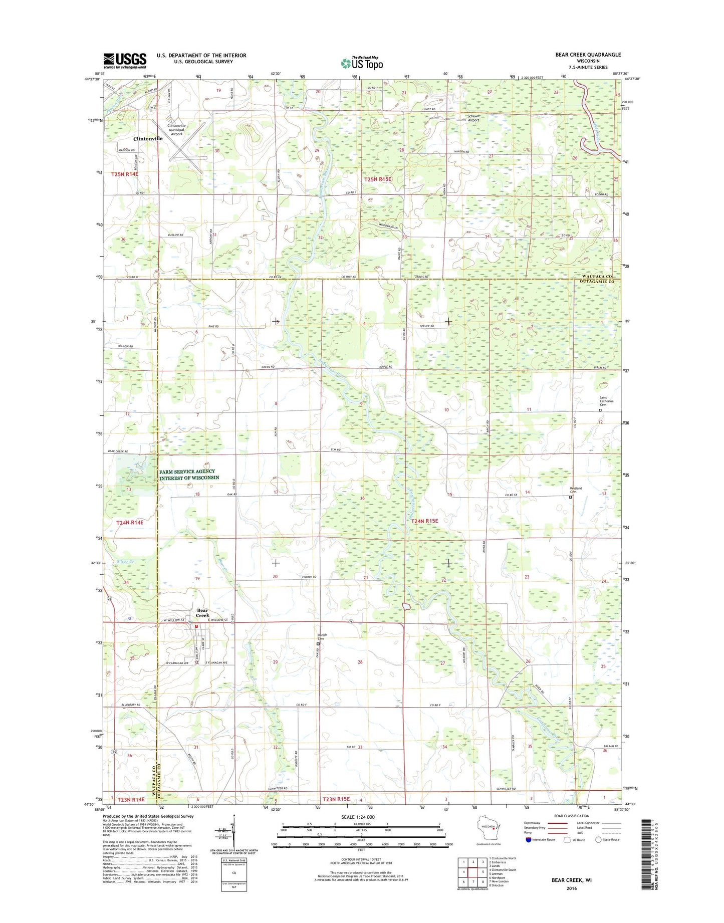
2022 topographic map quadrangle Bear Creek in the state of Wisconsin. Scale: 1:24000. Based on the newly updated USGS 7.5' US Topo map series, this map is in the following counties: Outagamie, Waupaca. The map contains contour data, water features, and other items you are used to seeing on USGS maps, but also has updated roads and other features. This is the next generation of topographic maps. Printed on high-quality waterproof paper with UV fade-resistant inks.
Quads adjacent to this one:
West: Clintonville South
Northwest: Clintonville North
North: Embarrass
Northeast: Lunds
East: Leeman
Southeast: Shiocton
South: New London
Southwest: Northport
This map covers the same area as the classic USGS quad with code o44088e6.
Contains the following named places: Bear Creek, Bear Creek Corners, Bear Creek Elementary School, Bear Creek Fire Department, Bear Creek Police Department, Bear Creek Post Office, Clintonville Municipal Airport, Clintonville Wastewater Treatment Plant, Clover Lawn School, Clovernook School, Coffee Bridge School, Danish Cemetery, Deer Creek State Wildlife Area, Elder Row School, Evangeline School, Meadow Grove School, Pigeon River, Restland Cemetery, Saint Catherine Cemetery, Saint Marys Grade School, Schewe Airport, Silver Creek, Town of Deer Creek, Village of Bear Creek, WFCL-AM (Clintonville), WJMQ-FM (Clintonville)