MyTopo
Northport Wisconsin US Topo Map
Couldn't load pickup availability
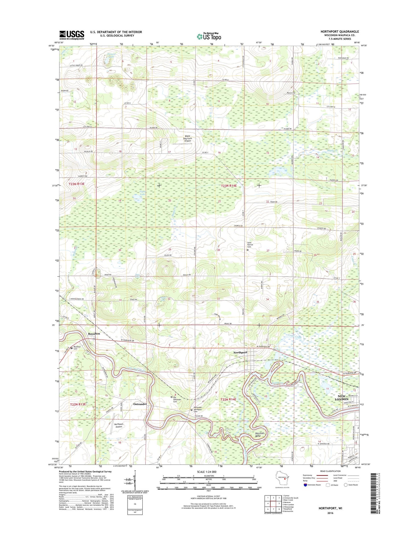
2022 topographic map quadrangle Northport in the state of Wisconsin. Scale: 1:24000. Based on the newly updated USGS 7.5' US Topo map series, this map is in the following counties: Waupaca. The map contains contour data, water features, and other items you are used to seeing on USGS maps, but also has updated roads and other features. This is the next generation of topographic maps. Printed on high-quality waterproof paper with UV fade-resistant inks.
Quads adjacent to this one:
West: Manawa
Northwest: Symco
North: Clintonville South
Northeast: Bear Creek
East: New London
Southeast: Hortonville
South: Readfield
Southwest: Weyauwega
This map covers the same area as the classic USGS quad with code o44088d7.
Contains the following named places: Black Dog Farm Airport, Butler Lake, Carmel, Cedar Creek, Deer Lake, Driscol Lake, Fitzgerald Corners, Flynn Lake, Hatten Park, Little Wolf River, Lone Pine School, Maple Hill School, Mouse Creek, Mukwa Bottomland Forest State Natural Area, Mukwa State Wildlife Area, New London Middle / Intermediate School, New London Wastewater Treatment Plant, Northport, Northport Airport, Northport Census Designated Place, Nowell, Oakwood School, Old Ostrander Cemetery, Ostrander, Ostrander - Northport Cemetery, Parkview Elementary School, Pine Grove School, Royalton, Royalton Cemetery, Saint Patrick Cemetery, Saint Patrick Church, School Number 4, Shirttail Bend, Town of Lebanon, Vic-to-Rae Camp, Wolf River State Fishery Area, ZIP Code: 54961