MyTopo
Shiocton Wisconsin US Topo Map
Couldn't load pickup availability
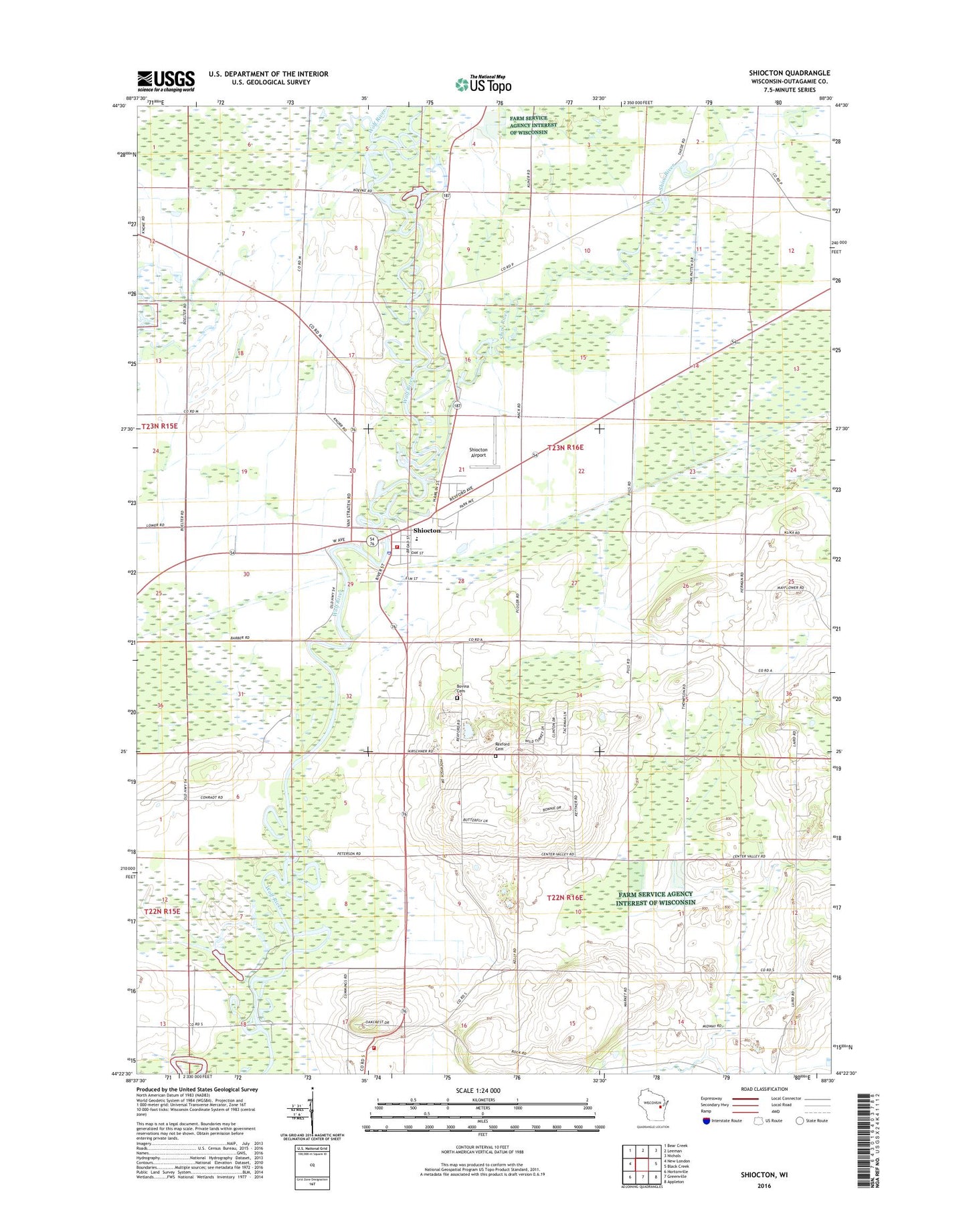
2022 topographic map quadrangle Shiocton in the state of Wisconsin. Scale: 1:24000. Based on the newly updated USGS 7.5' US Topo map series, this map is in the following counties: Outagamie. The map contains contour data, water features, and other items you are used to seeing on USGS maps, but also has updated roads and other features. This is the next generation of topographic maps. Printed on high-quality waterproof paper with UV fade-resistant inks.
Quads adjacent to this one:
West: New London
Northwest: Bear Creek
North: Leeman
Northeast: Nichols
East: Black Creek
Southeast: Appleton
South: Greenville
Southwest: Hortonville
This map covers the same area as the classic USGS quad with code o44088d5.
Contains the following named places: Black Creek, Countryside School, Ellington Fire Department, Hamlin Park, Jefferson School, LaFollette School, Liberty Bell School, Mack State Wildlife Area, Pershing School, Rexford Cemetery, Rexford School, Riverside School, Shioc River, Shiocton, Shiocton - Bovina Fire Department, Shiocton Airport, Shiocton Bovina Saint Denis Cemetery, Shiocton Elementary / Middle School, Shiocton High School, Shiocton Police Department, Shiocton Post Office, Town of Bovina, Village of Shiocton