MyTopo
Leeman Wisconsin US Topo Map
Couldn't load pickup availability
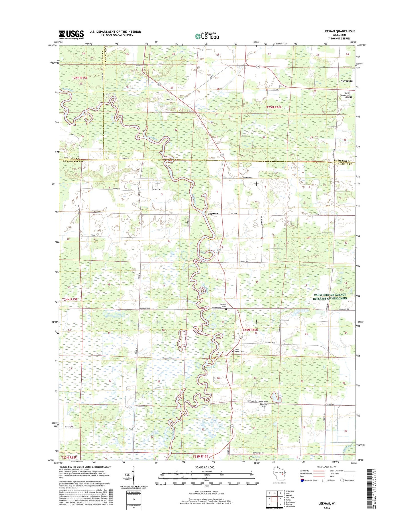
2022 topographic map quadrangle Leeman in the state of Wisconsin. Scale: 1:24000. Based on the newly updated USGS 7.5' US Topo map series, this map is in the following counties: Outagamie, Shawano, Waupaca. The map contains contour data, water features, and other items you are used to seeing on USGS maps, but also has updated roads and other features. This is the next generation of topographic maps. Printed on high-quality waterproof paper with UV fade-resistant inks.
Quads adjacent to this one:
West: Bear Creek
Northwest: Embarrass
North: Lunds
Northeast: Bonduel
East: Nichols
Southeast: Black Creek
South: Shiocton
Southwest: New London
This map covers the same area as the classic USGS quad with code o44088e5.
Contains the following named places: Leeman, Maine State Wildlife Area, Navarino Elementary School, Oak Hill Cemetery, Oakland School, Outagamie State Wildlife Area, Pleasant Hill School, Pleasant View School, Saint Lawrence Cemetery, South Maine Cemetery, South Maine Church, Sunset School, Town of Maine, Wolf River Landing Strip, WOZZ-FM (New London), ZIP Code: 54170