MyTopo
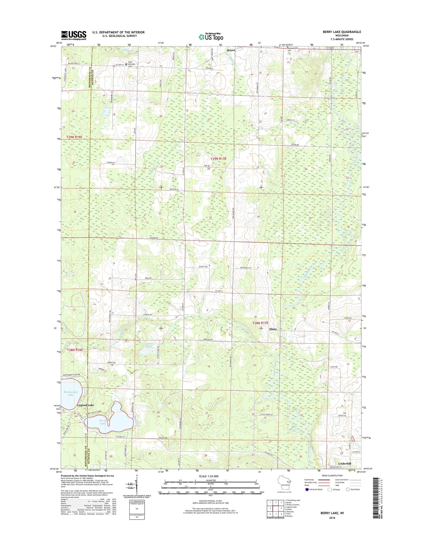
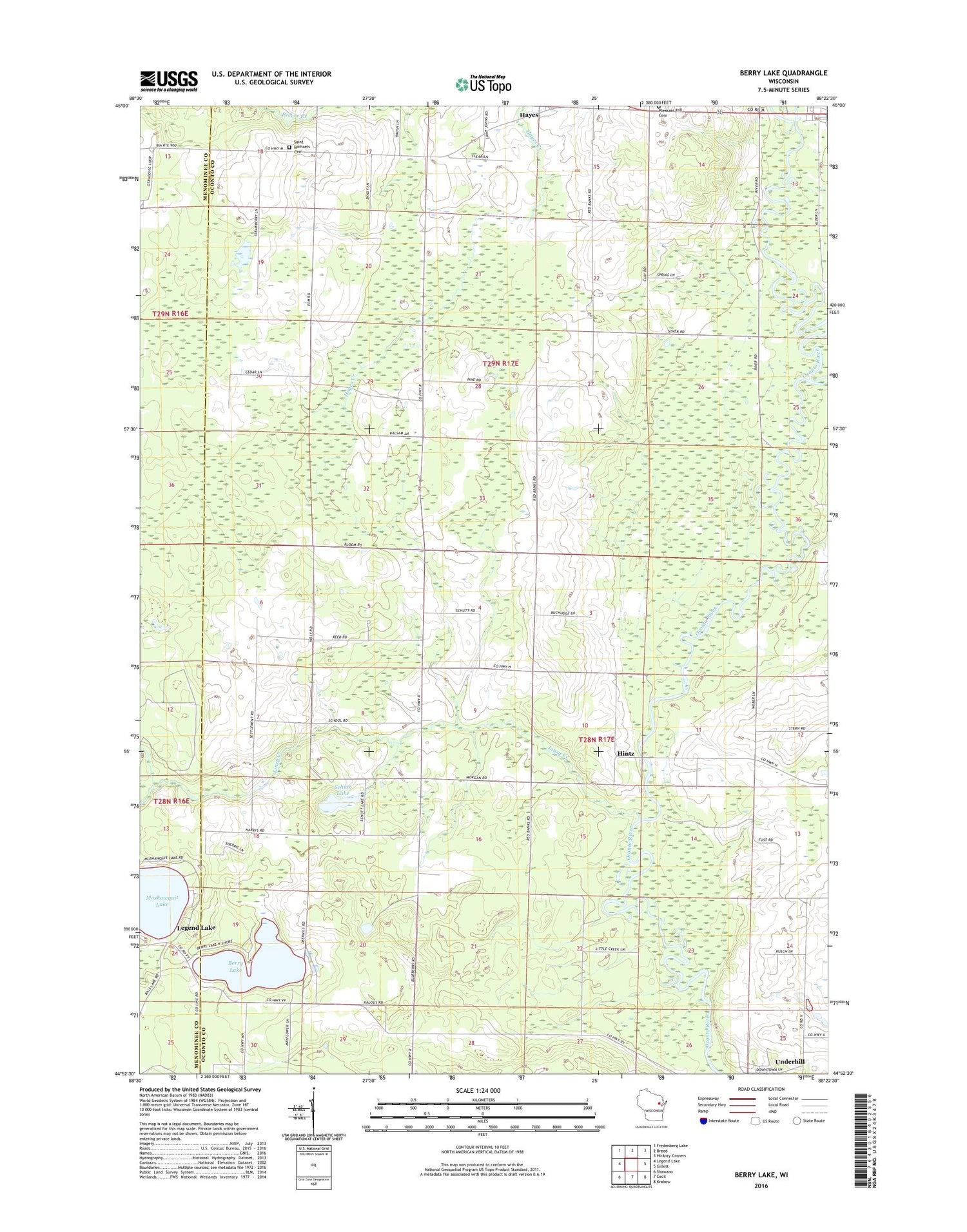
Berry Lake Wisconsin US Topo Map
Couldn't load pickup availability
2018 topographic map quadrangle Berry Lake in the state of Wisconsin. Scale: 1:24000. Based on the newly updated USGS 7.5' US Topo map series, this map is in the following counties: Oconto, Menominee. The map contains contour data, water features, and other items you are used to seeing on USGS maps, but also has updated roads and other features. This is the next generation of topographic maps. Printed on high-quality waterproof paper with UV fade-resistant inks.
Quads adjacent to this one:
West: Legend Lake
Northwest: Fredenberg Lake
North: Breed
Northeast: Hickory Corners
East: Gillett
Southeast: Krakow
South: Cecil
Southwest: Shawano
Contains the following named places: Berry Lake, Franks School, Grignon School, Hayes, Hintz, Linzy Brook School, Linzy Creek, Pleasant Hill Cemetery, Saint Michael's Catholic Church Cemetery, Schutt Lake, Sunny Lawn School, Suring Wastewater Treatment Plant, Town of How, Town of Underhill, Underhill, WRVM-FM (Suring), WSCO-TV (Suring)