MyTopo
Shawano Wisconsin US Topo Map
Couldn't load pickup availability
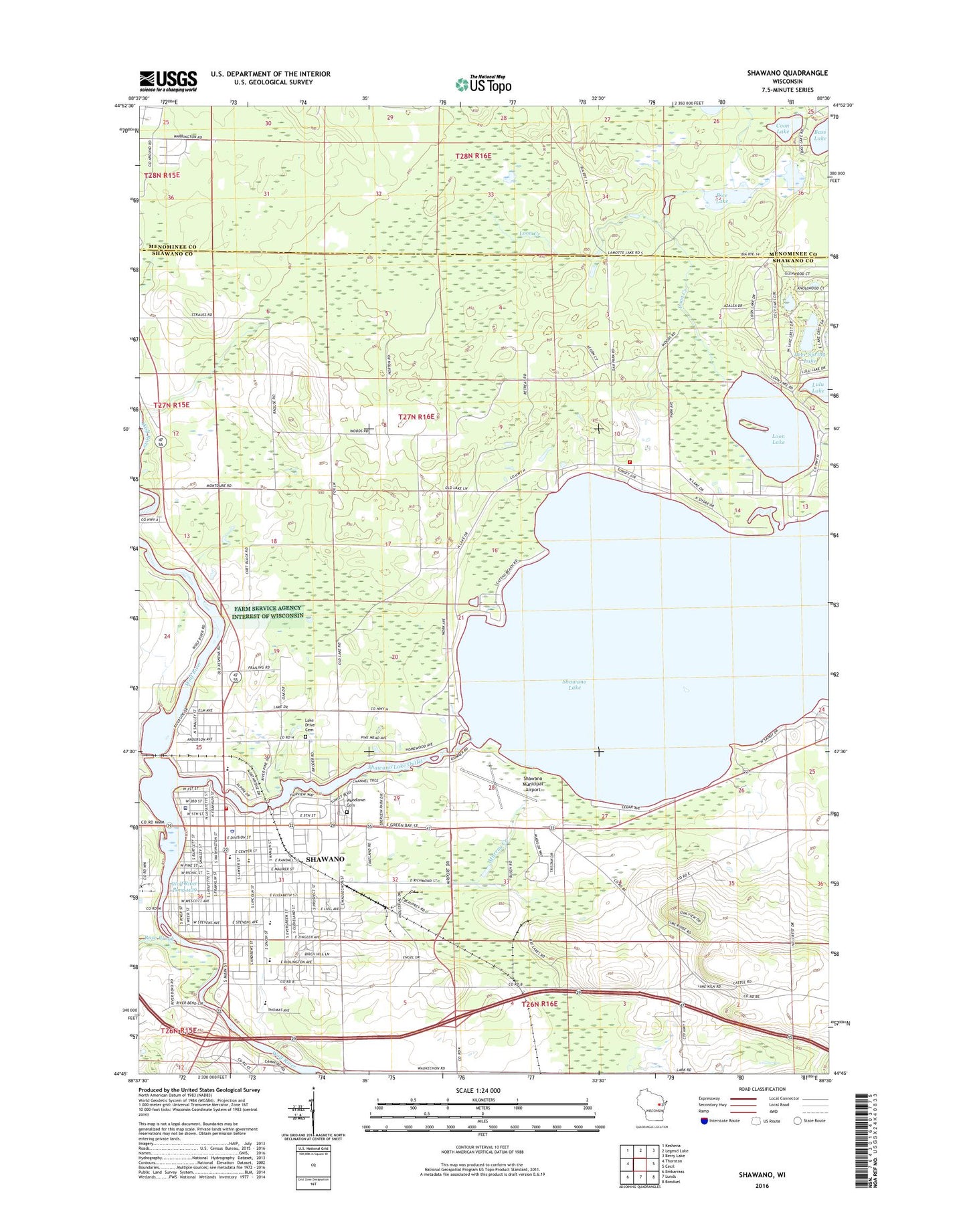
2022 topographic map quadrangle Shawano in the state of Wisconsin. Scale: 1:24000. Based on the newly updated USGS 7.5' US Topo map series, this map is in the following counties: Shawano, Menominee. The map contains contour data, water features, and other items you are used to seeing on USGS maps, but also has updated roads and other features. This is the next generation of topographic maps. Printed on high-quality waterproof paper with UV fade-resistant inks.
Quads adjacent to this one:
West: Thornton
Northwest: Keshena
North: Legend Lake
Northeast: Berry Lake
East: Cecil
Southeast: Bonduel
South: Lunds
Southwest: Embarrass
This map covers the same area as the classic USGS quad with code o44088g5.
Contains the following named places: Ainsworth School, Brener Elementary School, Camp Tekawitha, City of Shawano, Coon Lake, Dallman School, Deer Spring Lake, Divine Savior Lutheran School, Hotz Park, Keshena Census Designated Place, Lake Drive School, Limekiln Quarry, Lincoln Elementary School, Loon Lake, Lulu Lake, Moonlight Outdoor Theatre, Murray Creek, Murray Creek School, North Beach School, Oak Park School, Rice Lake, Rose Brook, Sacred Heart Catholic School, Saint James Lutheran School, Shalagoco Country Club, Shawano, Shawano 3WR393 Dam, Shawano Ambulance Service, Shawano Area Fire Department, Shawano Community Middle School, Shawano County Sheriff's Office, Shawano High School, Shawano Lake, Shawano Lake Outlet, Shawano Landfill, Shawano Medical Center, Shawano Municipal Airport, Shawano Police Department, Shawano Post Office, Town of Wescott, Warrington Addition, Wescott Lake Drive Cemetery, Wescott Town Law Enforcement, Wolf River Pond 1139, Woodlawn Cemetery, Zion American Lutheran Church