MyTopo
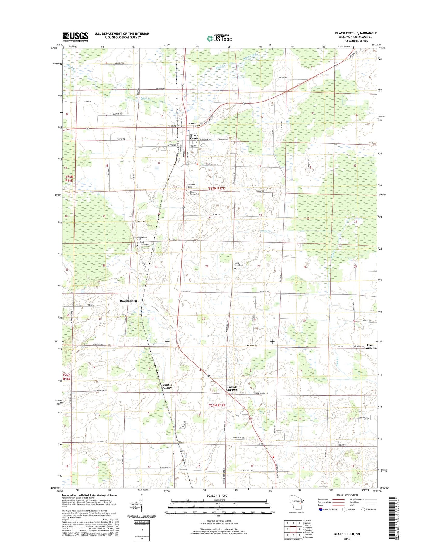
Black Creek Wisconsin US Topo Map
Couldn't load pickup availability
2018 topographic map quadrangle Black Creek in the state of Wisconsin. Scale: 1:24000. Based on the newly updated USGS 7.5' US Topo map series, this map is in the following counties: Outagamie. The map contains contour data, water features, and other items you are used to seeing on USGS maps, but also has updated roads and other features. This is the next generation of topographic maps. Printed on high-quality waterproof paper with UV fade-resistant inks.
Quads adjacent to this one:
West: Shiocton
Northwest: Leeman
North: Nichols
Northeast: Seymour
East: Freedom
Southeast: Kaukauna
South: Appleton
Southwest: Greenville
Contains the following named places: Apple Blossom Lane Orchard, Binghamton, Black Creek, Black Creek Ambulance Rescue Service, Black Creek Cemetery, Black Creek Elementary / Middle School, Black Creek Evangelical Cemetery, Black Creek Fire Department, Black Creek Police Department, Black Creek Post Office, Black Creek Wastewater Treatment Plant, Center Township Fire Department, Center Valley, Emmanuel Church, Fair View School, Five Corners Airways Airport, Forest School, Hillway School, Immanuel Evangelical Lutheran Church, Immanuel Lutheran Cemetery, Industrial Hollow School, Outagamie County, Pleasant Dale School, Rocky Road Quarry, Saint Johns United Church of Christ, Saint Marys Church, Sassman Cemetery, Sunny View School, Sunnyside School, Town of Black Creek, Twelve Corners, Village of Black Creek, ZIP Code: 54106