MyTopo
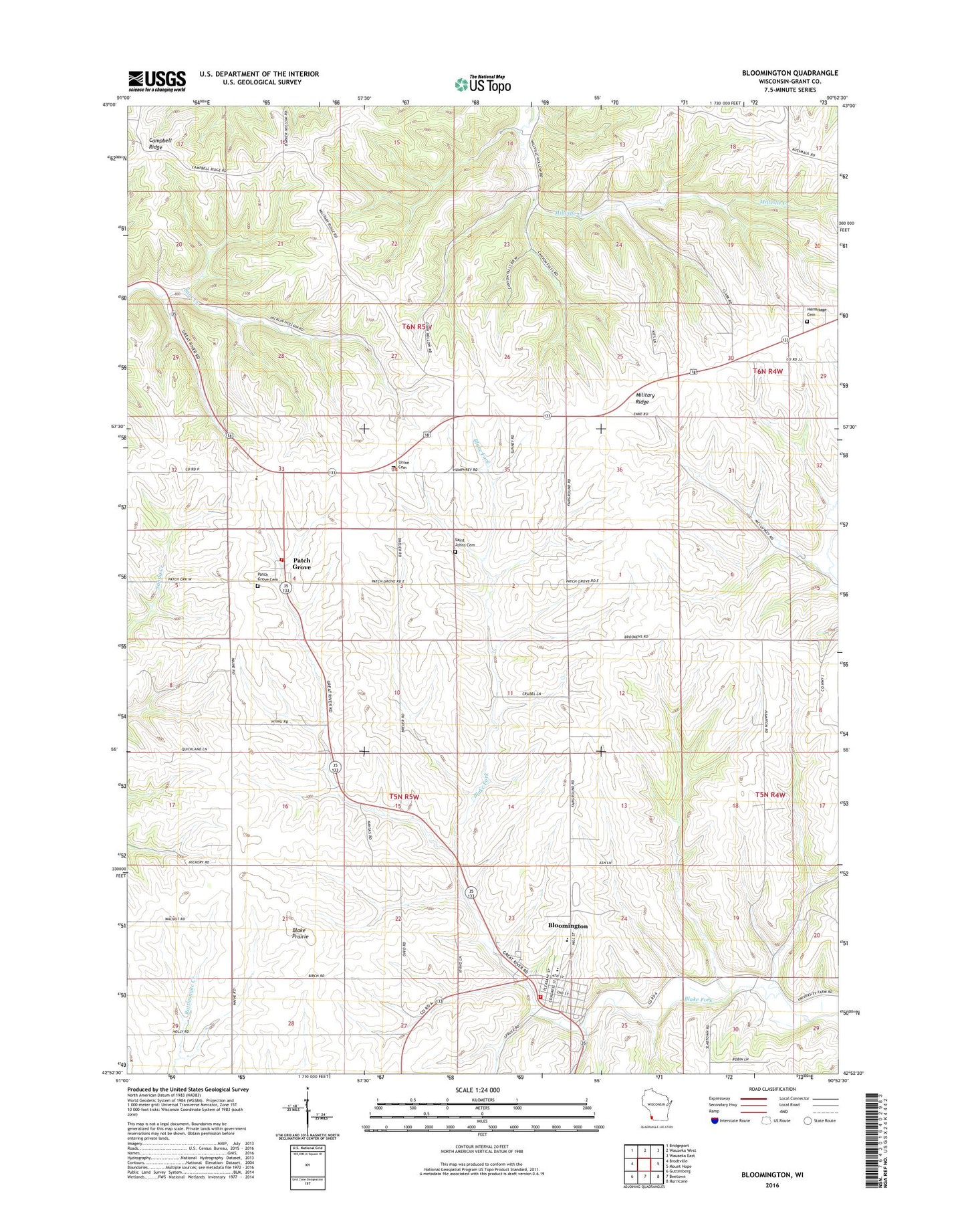
Bloomington Wisconsin US Topo Map
Couldn't load pickup availability
2022 topographic map quadrangle Bloomington in the state of Wisconsin. Scale: 1:24000. Based on the newly updated USGS 7.5' US Topo map series, this map is in the following counties: Grant. The map contains contour data, water features, and other items you are used to seeing on USGS maps, but also has updated roads and other features. This is the next generation of topographic maps. Printed on high-quality waterproof paper with UV fade-resistant inks.
Quads adjacent to this one:
West: Brodtville
Northwest: Bridgeport
North: Wauzeka West
Northeast: Wauzeka East
East: Mount Hope
Southeast: Hurricane
South: Beetown
Southwest: Guttenberg
This map covers the same area as the classic USGS quad with code o42090h8.
Contains the following named places: Bloomington, Bloomington Fire Department, Bloomington Post Office, Breezy L Farms, Campbell Ridge, Finn Quarry, Hermitage Cemetery, Mac D Farms, Maryline Farm, Military Ridge, Moravits Farm, Patch Grove, Patch Grove Cemetery, Patch Grove Fire Department, Patch Grove Post Office, River Ridge Elementary School, River Ridge High School, River Ridge Middle School, Saint Johns Cemetery, Saint Mary's School, Town of Patch Grove, Union Cemetery, Village of Bloomington, Village of Patch Grove, West Grant Rescue Squad, Willowbrook Farm, ZIP Code: 53817