MyTopo
Bridgeport Wisconsin US Topo Map
Couldn't load pickup availability
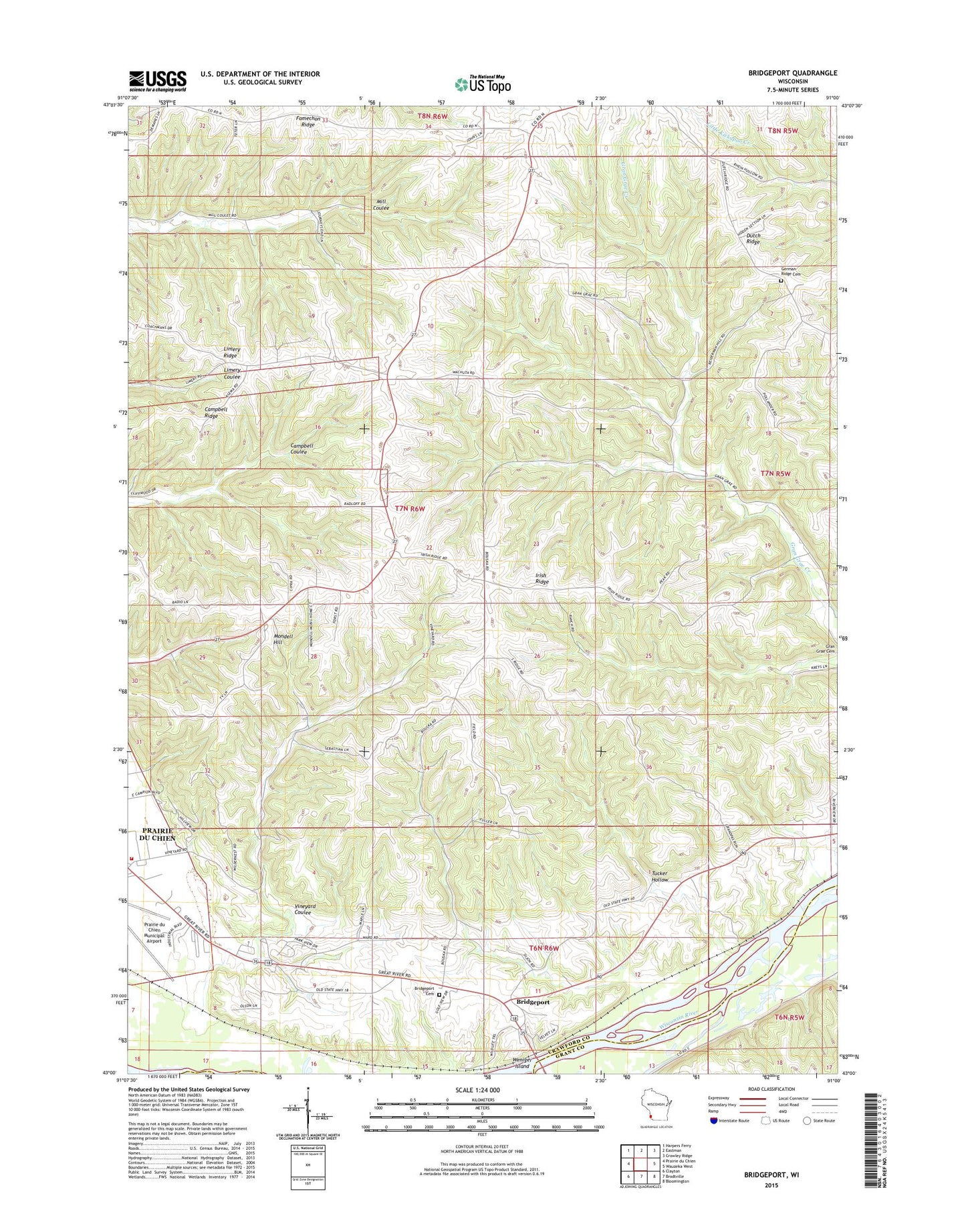
2022 topographic map quadrangle Bridgeport in the state of Wisconsin. Scale: 1:24000. Based on the newly updated USGS 7.5' US Topo map series, this map is in the following counties: Crawford, Grant. The map contains contour data, water features, and other items you are used to seeing on USGS maps, but also has updated roads and other features. This is the next generation of topographic maps. Printed on high-quality waterproof paper with UV fade-resistant inks.
Quads adjacent to this one:
West: Prairie du Chien
Northwest: Harpers Ferry
North: Eastman
Northeast: Crowley Ridge
East: Wauzeka West
Southeast: Bloomington
South: Brodtville
Southwest: Clayton
This map covers the same area as the classic USGS quad with code o43091a1.
Contains the following named places: Bridgeport, Bridgeport Cemetery, Bridgeport School, Campbell Ridge, Crossing Rivers Health Medical Center, Dutch Ridge Cemetery, Dutch Ridge School, Famechon Ridge, Famechon School, Irish Ridge, Irish Ridge School, Limery Ridge, Limery Ridge School, Mondell Hill, Prairie du Chien Country Club, Prairie du Chien Municipal Airport, Rural Bridgeport and Prairie du Chien Volunteer Fire Department, Sevenmile School, Shihata Orchard, Town of Bridgeport, Town of Prairie du Chien, Tucker Hollow, Vineyard Coulee, Vineyard Coulee School, White Corners, WPRE-FM (Prairie du Chien), Wrights Ferry School, ZIP Code: 53821