MyTopo
Mount Hope Wisconsin US Topo Map
Couldn't load pickup availability
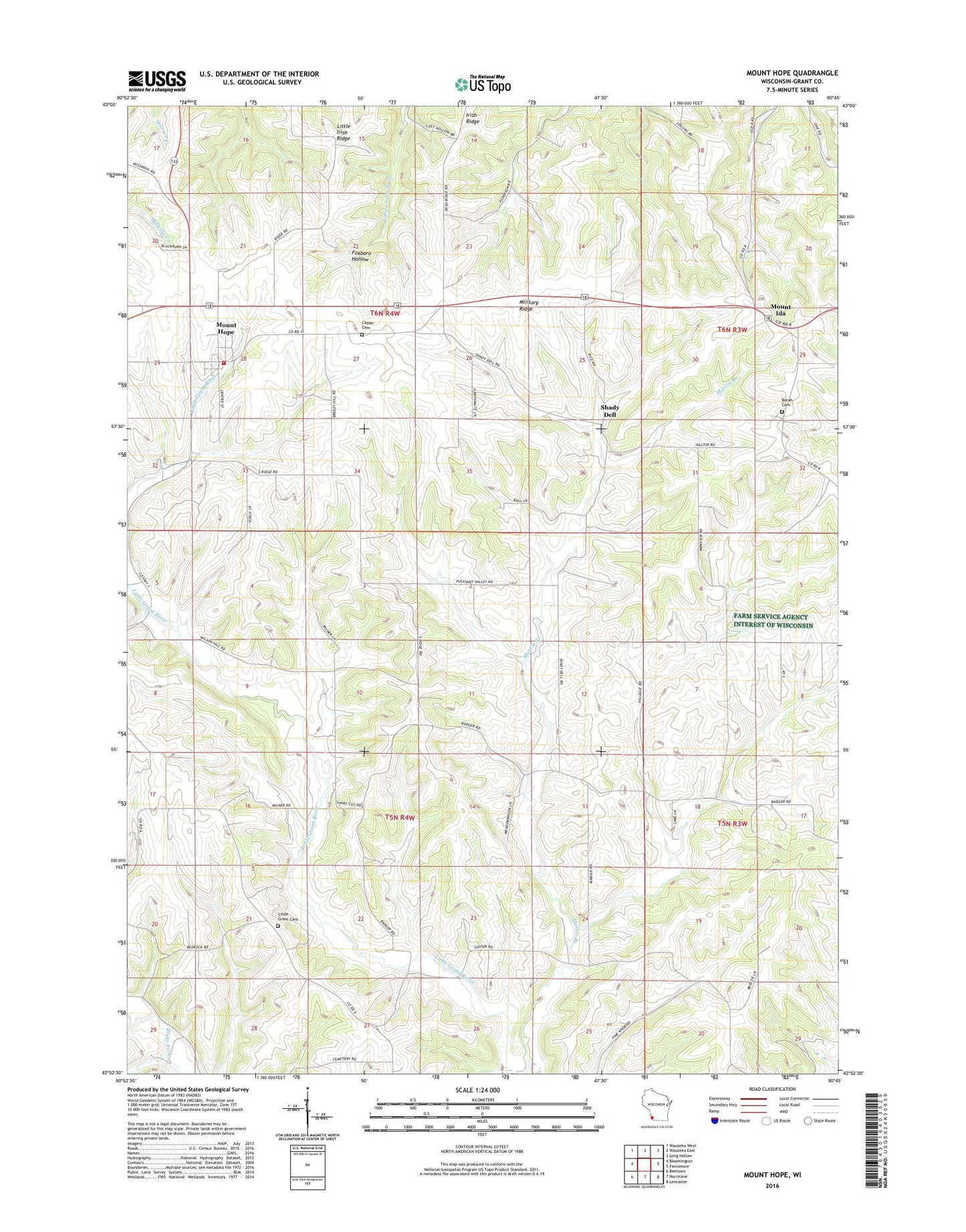
2022 topographic map quadrangle Mount Hope in the state of Wisconsin. Scale: 1:24000. Based on the newly updated USGS 7.5' US Topo map series, this map is in the following counties: Grant. The map contains contour data, water features, and other items you are used to seeing on USGS maps, but also has updated roads and other features. This is the next generation of topographic maps. Printed on high-quality waterproof paper with UV fade-resistant inks.
Quads adjacent to this one:
West: Bloomington
Northwest: Wauzeka West
North: Wauzeka East
Northeast: Long Hollow
East: Fennimore
Southeast: Lancaster
South: Hurricane
Southwest: Beetown
This map covers the same area as the classic USGS quad with code o42090h7.
Contains the following named places: 0.37 Reservoir, 53816, Badger School, Borah Cemetery, C Jeidy Farms Airport, Casler Cemetery, Fennimore Community School, Hidden Valley Farm, Hutchinson Farm, Irish Ridge, Jam Dairy, Little Grant Farms, Little Grant Union Cemetery, Little Irish Ridge, Mount Hope, Mount Hope Post Office, Mount Hope Volunteer Fire Department, Mount Ida, Pleasant Valley Farms, Pluemer G8020 Dam, Shady Dell, Town of Little Grant, Town of Mount Hope, Village of Mount Hope