MyTopo
Blue River Wisconsin US Topo Map
Couldn't load pickup availability
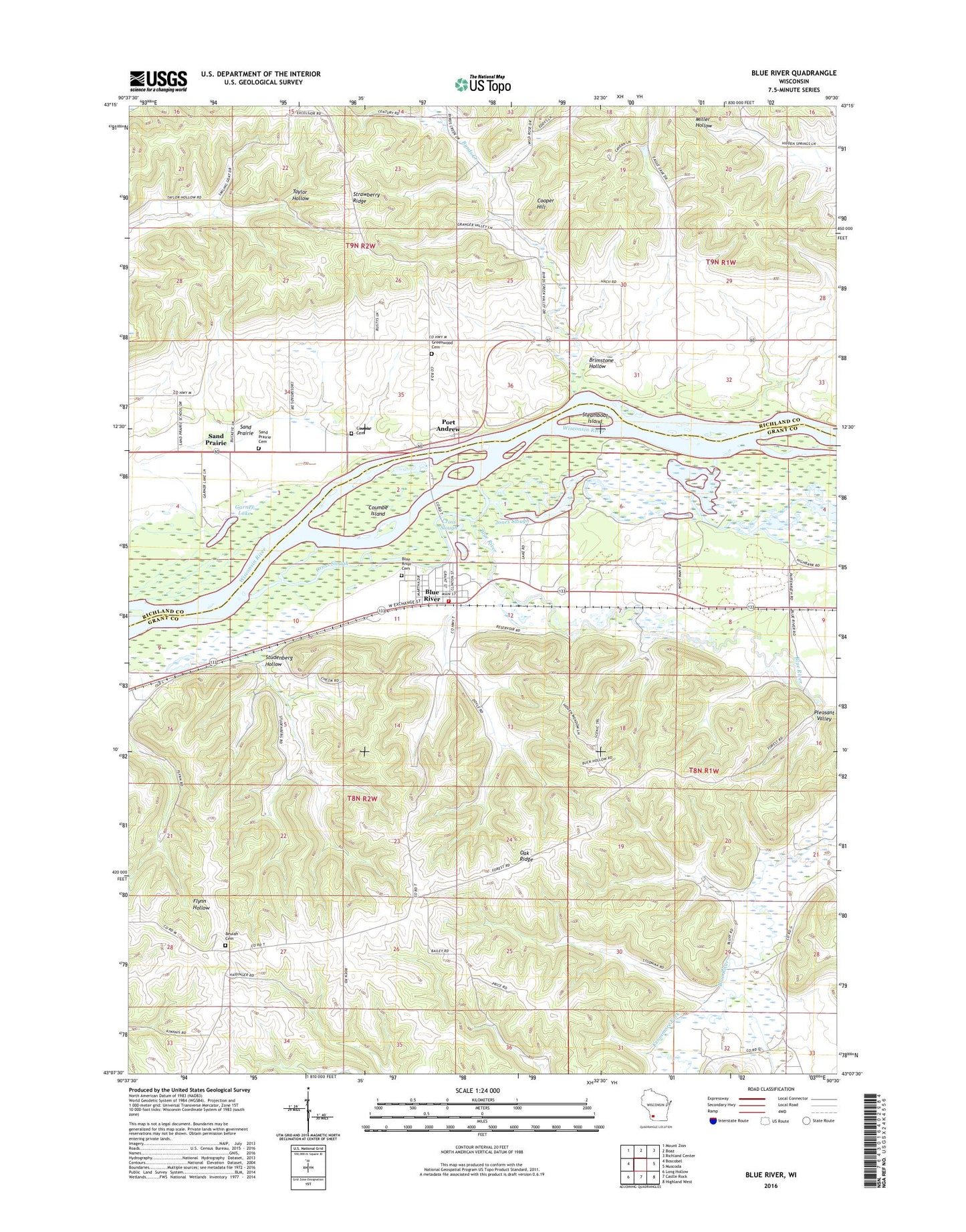
2022 topographic map quadrangle Blue River in the state of Wisconsin. Scale: 1:24000. Based on the newly updated USGS 7.5' US Topo map series, this map is in the following counties: Grant, Richland. The map contains contour data, water features, and other items you are used to seeing on USGS maps, but also has updated roads and other features. This is the next generation of topographic maps. Printed on high-quality waterproof paper with UV fade-resistant inks.
Quads adjacent to this one:
West: Boscobel
Northwest: Mount Zion
North: Boaz
Northeast: Richland Center
East: Muscoda
Southeast: Highland West
South: Castle Rock
Southwest: Long Hollow
This map covers the same area as the classic USGS quad with code o43090b5.
Contains the following named places: 0.4 Reservoir, 1.28 Reservoir, 53518, Beulah Cemetery, Black School, Blue Mountain Orchard, Blue River, Blue River Bluffs State Natural Area, Blue River Cemetery, Blue River Fire and Rescue, Blue River Post Office, Blue River Sand Barrens State Natural Area, Blue River Wastewater Treatment Facility, Brimstone Group H855 Dam, Brimstone Hollow, Byrds Creek, Byrds Creek Stock Farm, Cooper Hill, Coumbe Cemetery, Coumbe Island, Cross Slough, Eagle Valley Farm, Fennimore Fork, Garner Lake, Glen Eagle Farm, Greenwood Cemetery, Haskins School, Heberlin School, Jones Slough, Kite School, Oak Ridge, Peterson G9917 Dam, Pine Grove Stock and Dairy Farm, Pleasant Lawn Stock Farm, Pleasant Valley, Port Andrew, Sand Prairie, Sand Prairie Cemetery, School Number 2, School Number 4, South Lawn Stock Farm, Steamboat Island, Strawberry Ridge, Studenberg Hollow, Tisdale Homestead, Top T Farms, Town of Richwood, Town of Watterstown, Tyler School, Upper Byrds Creek School, Valley Farm, Village of Blue River