MyTopo
Sayner Wisconsin US Topo Map
Couldn't load pickup availability
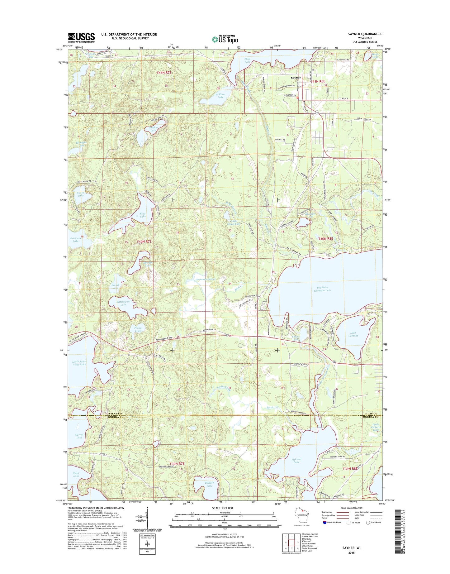
2022 topographic map quadrangle Sayner in the state of Wisconsin. Scale: 1:24000. Based on the newly updated USGS 7.5' US Topo map series, this map is in the following counties: Vilas, Oneida. The map contains contour data, water features, and other items you are used to seeing on USGS maps, but also has updated roads and other features. This is the next generation of topographic maps. Printed on high-quality waterproof paper with UV fade-resistant inks.
Quads adjacent to this one:
West: Woodruff
Northwest: Boulder Junction
North: White Sand Lake
Northeast: Star Lake
East: Saint Germain
Southeast: Dam Lake
South: Lake Tomahawk
Southwest: Hazelhurst
This map covers the same area as the classic USGS quad with code o45089h5.
Contains the following named places: Big Saint Germain 1909C361 Dam, Big Saint Germain Lake, Bittersweet Lake, Bittersweet Lakes State Natural Area, Border Creek, Buffalo Lake, Butterfly Lake, Erickson Lake, Fawn Lake, Hermanson Springs, Hobo Lake, Kasomo Lake, Klondike Lake, Lake Content, Little Arbor Vitae Lake, Little Cloud Lake, Lost Creek, Mud Creek, Muskellunge Lookout Tower, Northern Highland-American Legion State Forest, Oberlin Lake, Pickerel Lake, Plum Creek, Plum Lake Ambulance Service, Plum Lake Golf Course, Plum Lake Township Volunteer Fire Department Station 1, Prong Lake, Roach Lake, Ross Lake, Saint Germain River, Saint Marys Catholic Church, Sayner, Sayner Census Designated Place, Sayner Post Office, Shepherd of the Lakes Lutheran Church, Smith Lake, West Branch Plum Creek, West Plum Lake, Witches Lake