MyTopo
Briggsville Wisconsin US Topo Map
Couldn't load pickup availability
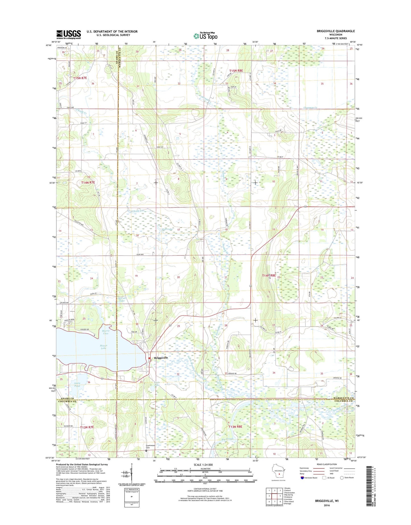
2018 topographic map quadrangle Briggsville in the state of Wisconsin. Scale: 1:24000. Based on the newly updated USGS 7.5' US Topo map series, this map is in the following counties: Marquette, Adams, Columbia. The map contains contour data, water features, and other items you are used to seeing on USGS maps, but also has updated roads and other features. This is the next generation of topographic maps. Printed on high-quality waterproof paper with UV fade-resistant inks.
Quads adjacent to this one:
West: Big Spring
Northwest: Brooks
North: Oxford
Northeast: Packwaukee
East: Endeavor
Southeast: Portage
South: Pine Island
Southwest: Lewiston
Contains the following named places: Amey Pond, Big Slough, Briggsville, Briggsville 1869C221 Dam, Briggsville Census Designated Place, Briggsville Fire Department, Briggsville Post Office, Douglas Center, Douglas Church, Greenwood Cemetery, Little Lake, Mason Lake, Mason Lake 37, McCall Lake, Morris Cove, Mud Lake, Neenah Creek Elementary School, Norlings Landing Field, O'Keefe Creek, South Branch Neenah Creek, Stafford School, Summerton Bog State Natural Area, Town of Douglas, ZIP Code: 53920