MyTopo
Endeavor Wisconsin US Topo Map
Couldn't load pickup availability
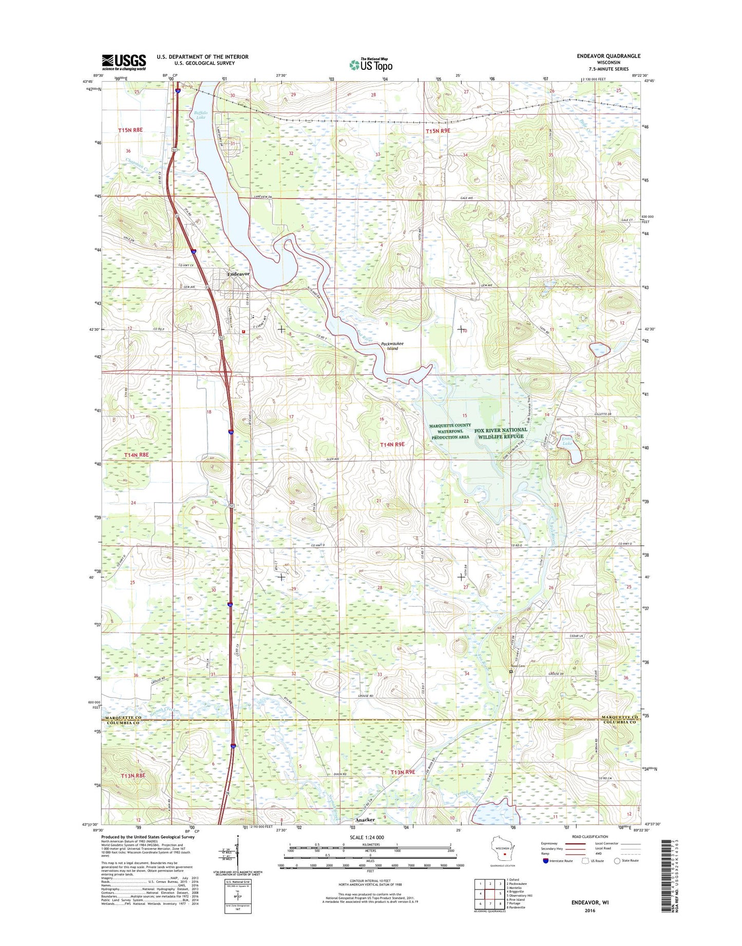
2022 topographic map quadrangle Endeavor in the state of Wisconsin. Scale: 1:24000. Based on the newly updated USGS 7.5' US Topo map series, this map is in the following counties: Marquette, Columbia. The map contains contour data, water features, and other items you are used to seeing on USGS maps, but also has updated roads and other features. This is the next generation of topographic maps. Printed on high-quality waterproof paper with UV fade-resistant inks.
Quads adjacent to this one:
West: Briggsville
Northwest: Oxford
North: Packwaukee
Northeast: Montello
East: Observatory Hill
Southeast: Pardeeville
South: Portage
Southwest: Pine Island
This map covers the same area as the classic USGS quad with code o43089f4.
Contains the following named places: Anacker, Buffalo Shore Estates, Chapman Creek, Endeavor, Endeavor - Moundville Fire and Rescue, Endeavor Elementary School, Endeavor Post Office, Ennis Lake, Fox River National Wildlife Refuge, French Creek, French Creek Wildlife Area Pool Number 2, French Creek Wildlife Refuge 2WP1497 Dam, John Muir Memorial County Park, Moundville Church, Muir Park State Natural Area, Neenah Creek, Packwaukee Island, Rood Cemetery, Smith Lake, Town of Moundville, Village of Endeavor, ZIP Code: 53930