MyTopo
Packwaukee Wisconsin US Topo Map
Couldn't load pickup availability
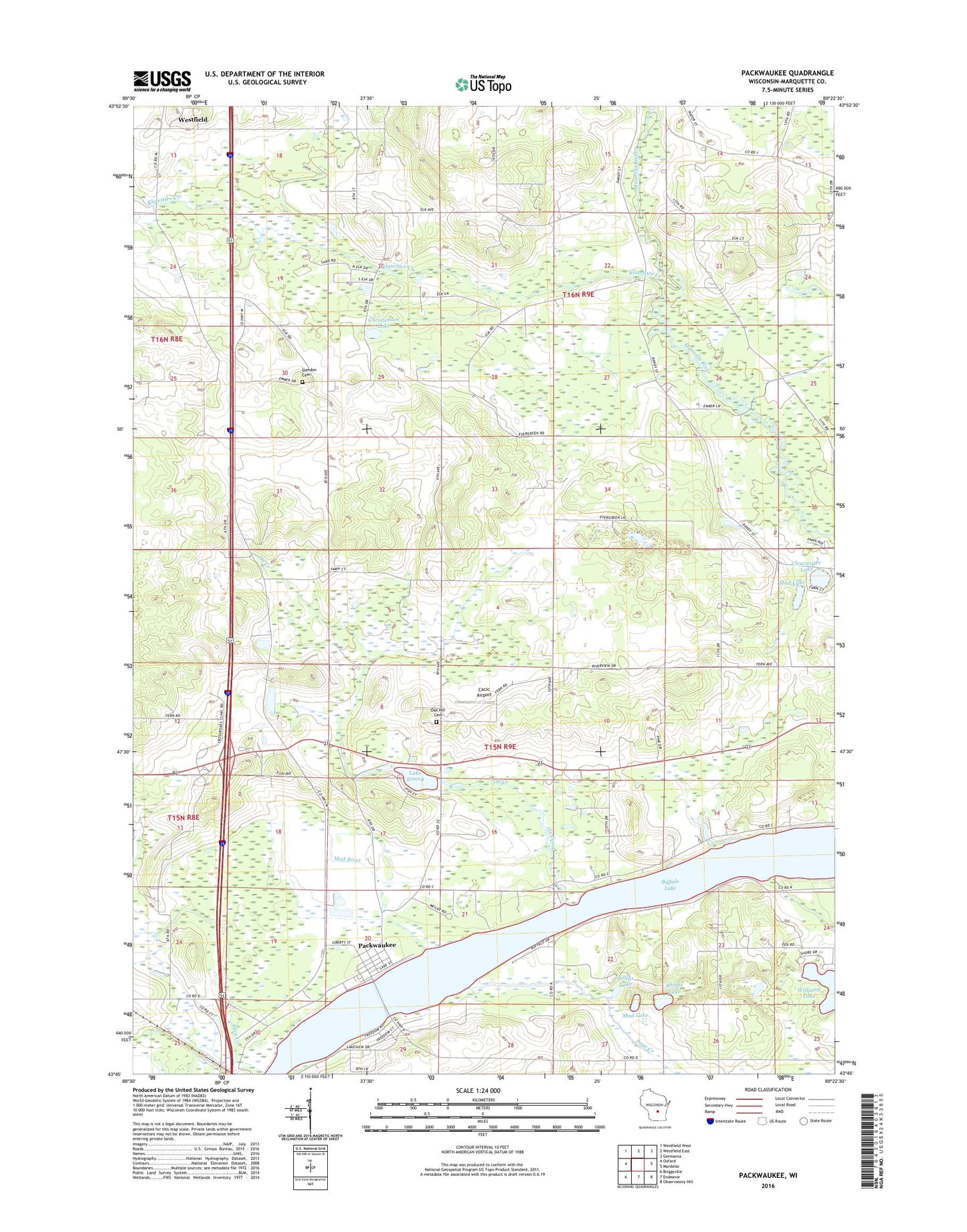
2022 topographic map quadrangle Packwaukee in the state of Wisconsin. Scale: 1:24000. Based on the newly updated USGS 7.5' US Topo map series, this map is in the following counties: Marquette. The map contains contour data, water features, and other items you are used to seeing on USGS maps, but also has updated roads and other features. This is the next generation of topographic maps. Printed on high-quality waterproof paper with UV fade-resistant inks.
Quads adjacent to this one:
West: Oxford
Northwest: Westfield West
North: Westfield East
Northeast: Germania
East: Montello
Southeast: Observatory Hill
South: Endeavor
Southwest: Briggsville
This map covers the same area as the classic USGS quad with code o43089g4.
Contains the following named places: Allen Creek, Big Pine Lake, Bright Lake, Cacic Airport, Christensen Lake, Clearwater Lake, Klawitter Creek, Lake Emery, Lake Emery 5, Mad River, Marquette County, Montello Corners, Mud Lake, Oak Hill Cemetery, Ox Creek, Packwaukee, Packwaukee Census Designated Place, Packwaukee Post Office, Page Creek, Page Creek Marsh State Natural Area, Pollys Lake, Richards Mill 3WR1902 Dam, Sandwater Airport, Sheldon Cemetery, Town of Harris, Town of Packwaukee, Westfield School, Williams Lake, ZIP Code: 53953