MyTopo
Bryant Wisconsin US Topo Map
Couldn't load pickup availability
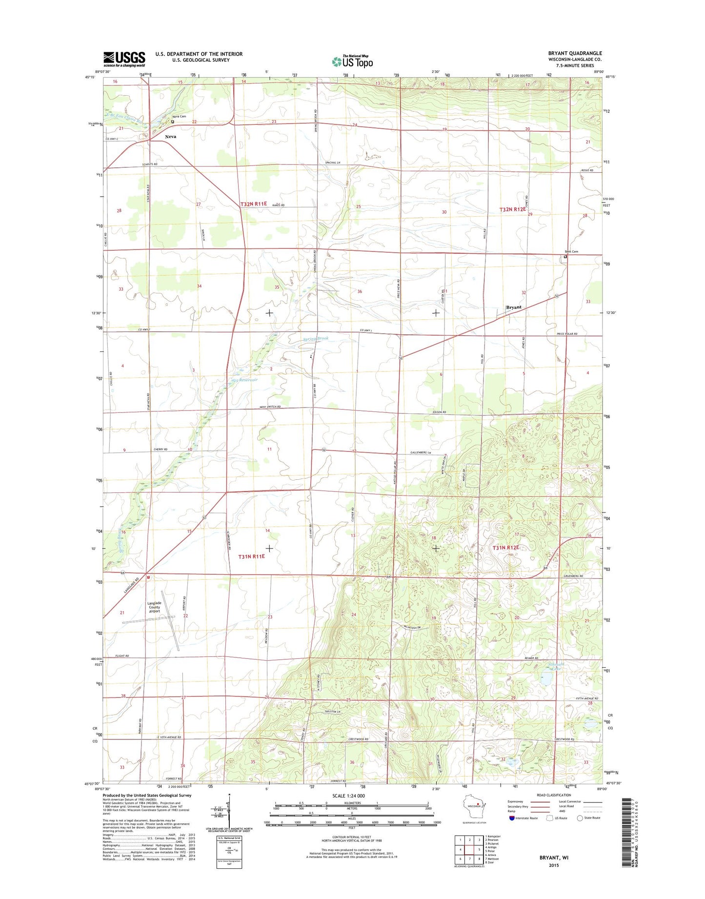
2022 topographic map quadrangle Bryant in the state of Wisconsin. Scale: 1:24000. Based on the newly updated USGS 7.5' US Topo map series, this map is in the following counties: Langlade. The map contains contour data, water features, and other items you are used to seeing on USGS maps, but also has updated roads and other features. This is the next generation of topographic maps. Printed on high-quality waterproof paper with UV fade-resistant inks.
Quads adjacent to this one:
West: Antigo
Northwest: Kempster
North: Pearson
Northeast: Pickerel
East: Polar
Southeast: Zoar
South: Mattoon
Southwest: Aniwa
This map covers the same area as the classic USGS quad with code o45089b1.
Contains the following named places: 25 Reservoir, Antigo Township Fire Department, Bent Cemetery, Bryant, Edison School, Fairview School, Franklin School, Grandview Orchard, Green Valley School, Highland School, Langlade County Airport, Neff Switch School, Neva, Polar Townhall, Saint Johns Church, Saint Peters Church, Schmuhl Lake, Selenski School, Skinner Dam, Spring Valley Elementary School, Springbrook School, Star Neva Cemetery, Town of Antigo, Town of Neva