MyTopo
Pearson Wisconsin US Topo Map
Couldn't load pickup availability
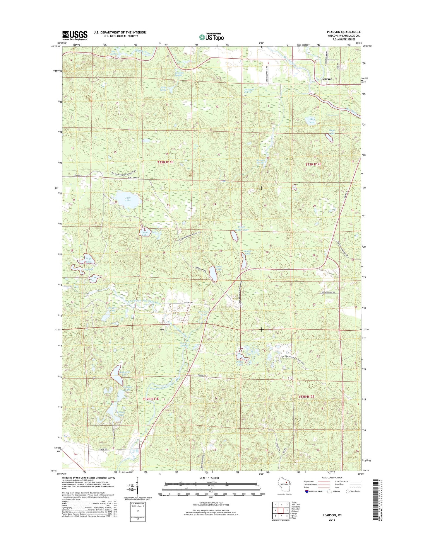
2022 topographic map quadrangle Pearson in the state of Wisconsin. Scale: 1:24000. Based on the newly updated USGS 7.5' US Topo map series, this map is in the following counties: Langlade. The map contains contour data, water features, and other items you are used to seeing on USGS maps, but also has updated roads and other features. This is the next generation of topographic maps. Printed on high-quality waterproof paper with UV fade-resistant inks.
Quads adjacent to this one:
West: Kempster
Northwest: Elcho
North: Post Lake
Northeast: Mole Lake
East: Pickerel
Southeast: Polar
South: Bryant
Southwest: Antigo
This map covers the same area as the classic USGS quad with code o45089c1.
Contains the following named places: Anderson Lake, Blue Springs, Cloverdale School, Crystal Spring Fish Hatchery, Ferguson Pond, Game Lake, Gilkey Lake, High Lake, Hunting River, Jack Lake, Langlade County, Low Lake, Markgras Springs, North Neva Lake, Pearson, Pence Lake, Pence Lake Lookout Tower, Peters Lake, Peters Marsh State Wildlife Area, Rogers Lake, Shadick Spring, South Neva Lake, Stevens Springs, Upper Ventor Lake, Ventor Lake, Veterans Memorial County Park, Willow Springs, Wolf River State Fishery Area, Wooduck Springs