MyTopo
Pickerel Wisconsin US Topo Map
Couldn't load pickup availability
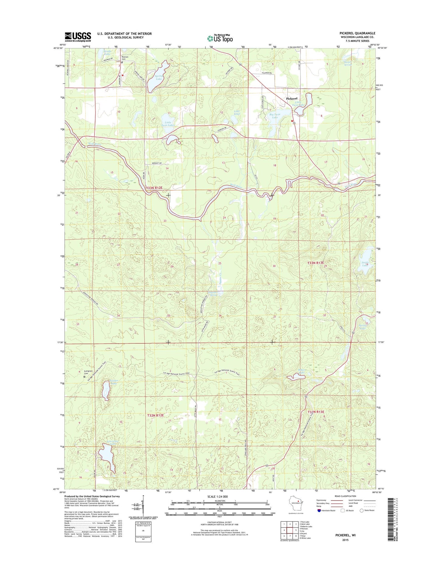
2023 topographic map quadrangle Pickerel in the state of Wisconsin. Scale: 1:24000. Based on the newly updated USGS 7.5' US Topo map series, this map is in the following counties: Langlade. The map contains contour data, water features, and other items you are used to seeing on USGS maps, but also has updated roads and other features. This is the next generation of topographic maps. Printed on high-quality waterproof paper with UV fade-resistant inks.
Quads adjacent to this one:
West: Pearson
Northwest: Post Lake
North: Mole Lake
Northeast: Roberts Lake
East: Lily
Southeast: White Lake
South: Polar
Southwest: Bryant
This map covers the same area as the classic USGS quad with code o45088c8.
Contains the following named places: Ainsworth Townhall, Augustyn Springs, Baker Lake, Big Twin Lake, Camp Ma-Ka-Ja-Wan, Duck Pond, Eddy Lake, Evergreen Cemetery, Fischer Lake, Harper Springs, Hindu Lake, Lake Ethel, Lawrence Lake, Lawrence Lake State Natural Area, Little Twin Lake, Little Twin Lakes, Muskrat Lake, New Saint Johns Church, Pearson Cemetery, Pearson School, Pickerel, Pickerel Post Office, Pickerel Volunteer Fire and Rescue Station 2, Pickerel Volunteer Fire and Rescue Station 3, Spring Lake, Squaw Creek, Turtle Lake