MyTopo
Polar Wisconsin US Topo Map
Couldn't load pickup availability
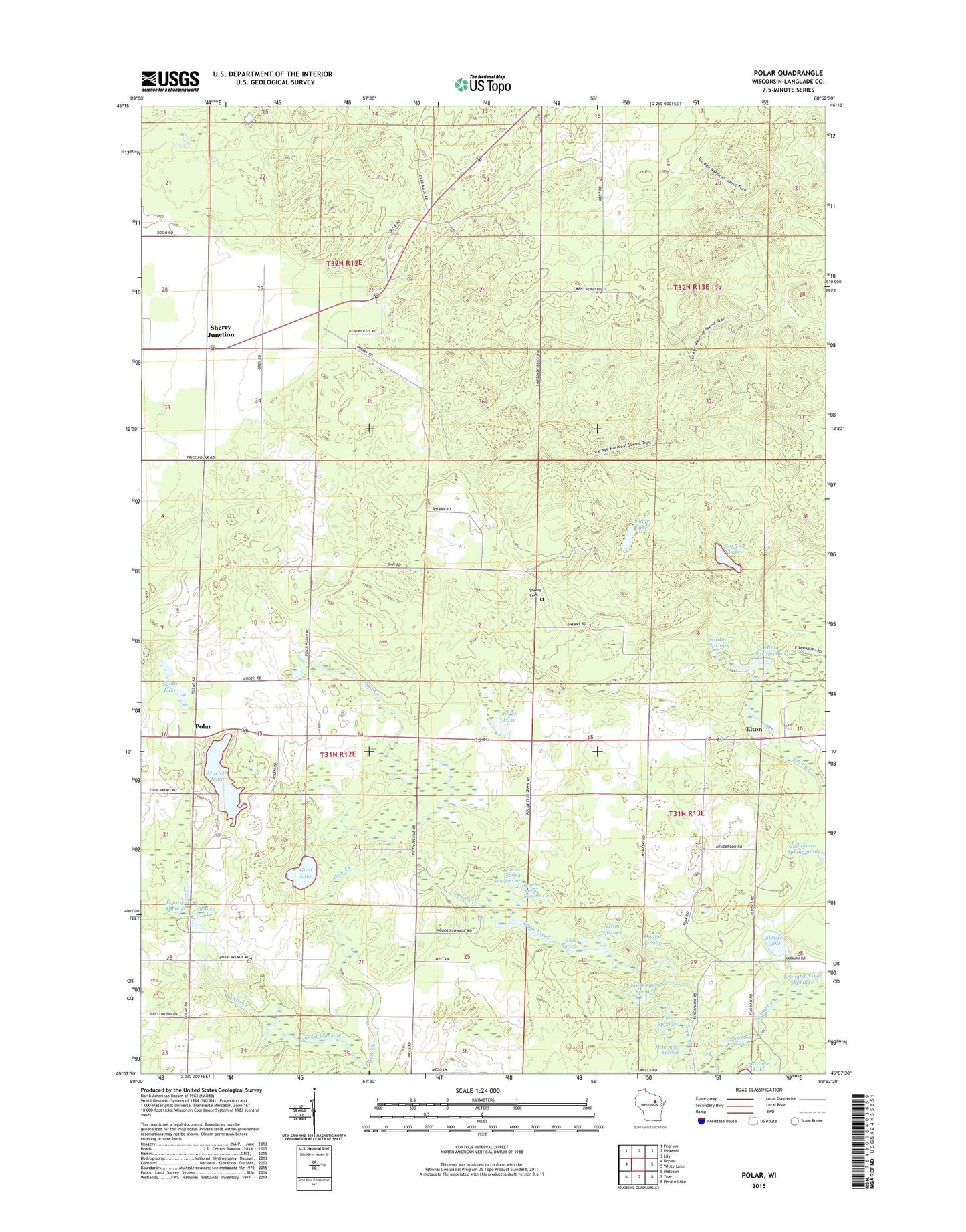
2022 topographic map quadrangle Polar in the state of Wisconsin. Scale: 1:24000. Based on the newly updated USGS 7.5' US Topo map series, this map is in the following counties: Langlade. The map contains contour data, water features, and other items you are used to seeing on USGS maps, but also has updated roads and other features. This is the next generation of topographic maps. Printed on high-quality waterproof paper with UV fade-resistant inks.
Quads adjacent to this one:
West: Bryant
Northwest: Pearson
North: Pickerel
Northeast: Lily
East: White Lake
Southeast: Perote Lake
South: Zoar
Southwest: Mattoon
This map covers the same area as the classic USGS quad with code o45088b8.
Contains the following named places: Clubhouse Springpond, Clubhouse Springpond State Fishery Area, Dodge Lake, Drew Creek, Elton, Elton Springpond, Garski Flowage, Goto Lake, Hatton Springs, Hogelee Spring Number One, Hogelee Spring Number Two, Hoglot Springs, Joyce Lake, Karbergers Springs, Kent Lookout Tower, Kent School, Krause Springs, Leonard Nixon Springs, McGee Creek, McGee Lake, Moonshine Springs, Mueller Lake, Nixon Springs, Norway Lake, Pine Springs, Polar, Punchout Springs, Rabe Lake, Rabe Lake State Fishery Area, Sherry Cemetery, Sherry Junction, Shuman School, Starks Springs, Sylan Lake, Town of Polar, Town of Price, Wilderness Church, Woods Flowage, Woods Flowage State Fishery Area, ZIP Code: 54418