MyTopo
Butternut Lake Wisconsin US Topo Map
Couldn't load pickup availability
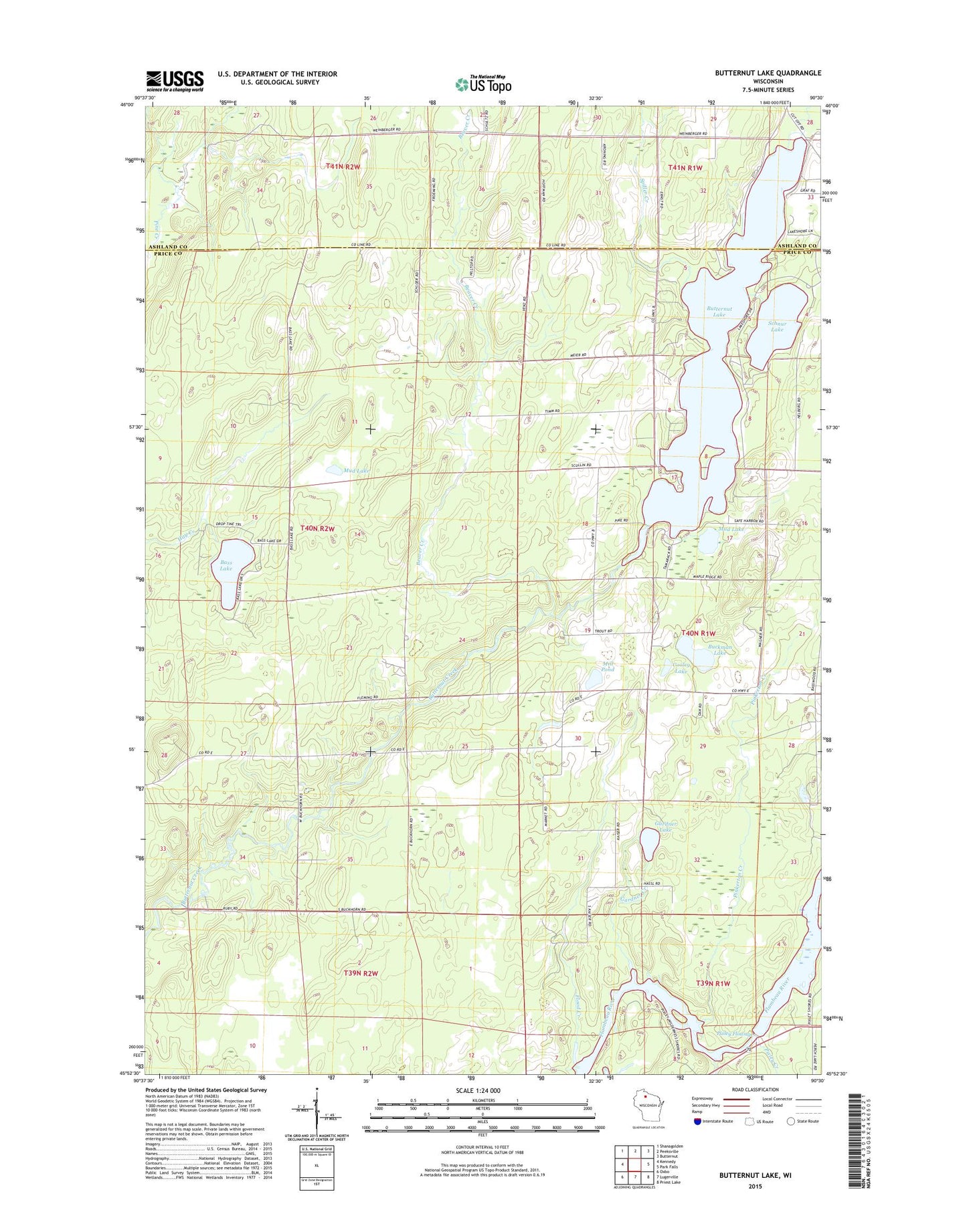
2018 topographic map quadrangle Butternut Lake in the state of Wisconsin. Scale: 1:24000. Based on the newly updated USGS 7.5' US Topo map series, this map is in the following counties: Price, Ashland. The map contains contour data, water features, and other items you are used to seeing on USGS maps, but also has updated roads and other features. This is the next generation of topographic maps. Printed on high-quality waterproof paper with UV fade-resistant inks.
Quads adjacent to this one:
West: Kennedy
Northwest: Shanagolden
North: Peeksville
Northeast: Butternut
East: Park Falls
Southeast: Priest Lake
South: Lugerville
Southwest: Oxbo
Contains the following named places: Arnold School, Bass Lake, Beaver Creek, Betsy Creek, Buckman Lake, Butternut Lake, Butternut School, Cooley Lake, Flood Creek, Gardner Creek, Gardner Lake, Kaiser, Kennedy Lookout Tower, Mill Pond, Mud Lake, Pinkerton Creek, Pixley Creek, Pixley Dam, Pixley Flowage, Pixley WP61 Dam, Schnur Lake, Spiller Creek, Town of Lake, Wilson School