MyTopo
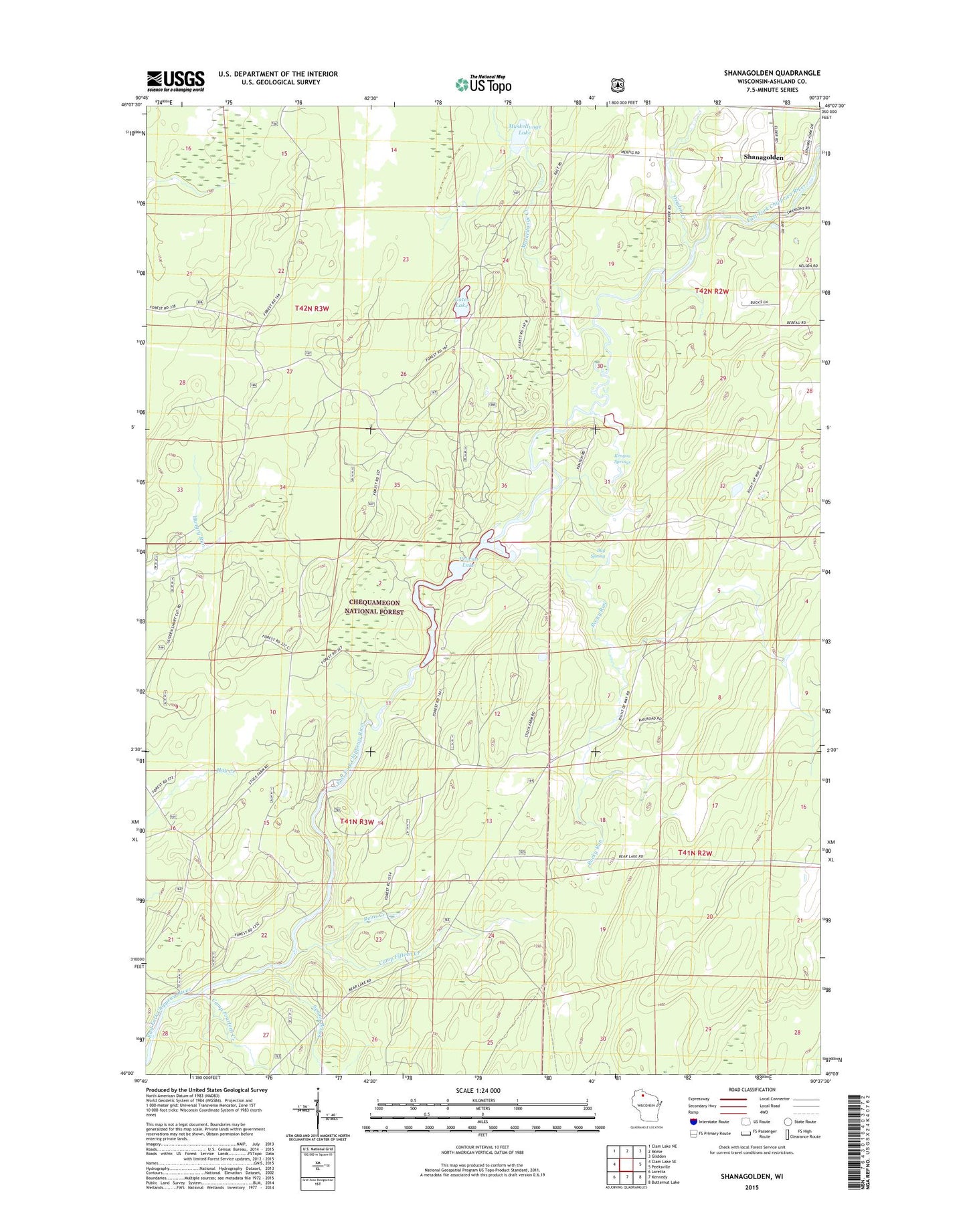
Shanagolden Wisconsin US Topo Map
Couldn't load pickup availability
Also explore the Shanagolden Forest Service Topo of this same quad for updated USFS data
2022 topographic map quadrangle Shanagolden in the state of Wisconsin. Scale: 1:24000. Based on the newly updated USGS 7.5' US Topo map series, this map is in the following counties: Ashland. The map contains contour data, water features, and other items you are used to seeing on USGS maps, but also has updated roads and other features. This is the next generation of topographic maps. Printed on high-quality waterproof paper with UV fade-resistant inks.
Quads adjacent to this one:
West: Clam Lake SE
Northwest: Clam Lake NE
North: Morse
Northeast: Glidden
East: Peeksville
Southeast: Butternut Lake
South: Kennedy
Southwest: Loretta
This map covers the same area as the classic USGS quad with code o46090a6.
Contains the following named places: Bay Spring, Camp Fifteen Creek, Camp Fourteen Creek, Cross Country Ski Area Point of Interest, Dryden Creek, Gates Lake, Kenyon Springs, Muskellunge Creek, Muskellunge Lake, Pelican Lake, Reins Creek, Rocky Run, Shanagolden, Spring Brook, Stock Farm Bridge Recreation Site, Town of Chippewa