MyTopo
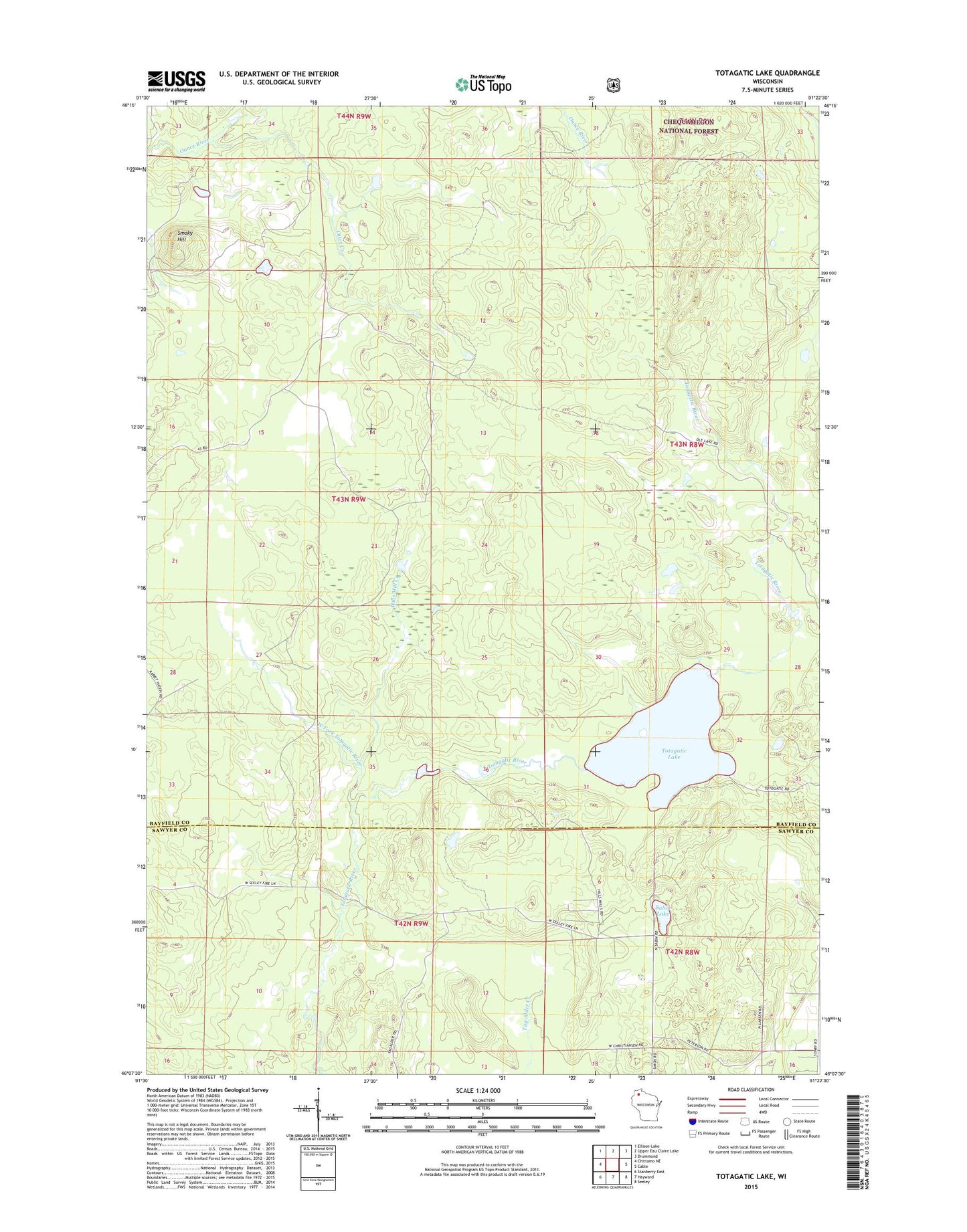
Totagatic Lake Wisconsin US Topo Map
Couldn't load pickup availability
Also explore the Totagatic Lake Forest Service Topo of this same quad for updated USFS data
2022 topographic map quadrangle Totagatic Lake in the state of Wisconsin. Scale: 1:24000. Based on the newly updated USGS 7.5' US Topo map series, this map is in the following counties: Bayfield, Sawyer. The map contains contour data, water features, and other items you are used to seeing on USGS maps, but also has updated roads and other features. This is the next generation of topographic maps. Printed on high-quality waterproof paper with UV fade-resistant inks.
Quads adjacent to this one:
West: Chittamo NE
Northwest: Ellison Lake
North: Upper Eau Claire Lake
Northeast: Drummond
East: Cable
Southeast: Seeley
South: Hayward
Southwest: Stanberry East
This map covers the same area as the classic USGS quad with code o46091b4.
Contains the following named places: Dawn Lake, Fuller Lake, Hills Mill Creek, Otter Creek, Sabin Lake, Sabin School, Smoky Hill, Smoky Hill Fire Tower, Totagatic Lake, Totagatic Lake State Wildlife Managament Area, West Fork Totagatic River