MyTopo
Upper Eau Claire Lake Wisconsin US Topo Map
Couldn't load pickup availability
Also explore the Upper Eau Claire Lake Forest Service Topo of this same quad for updated USFS data
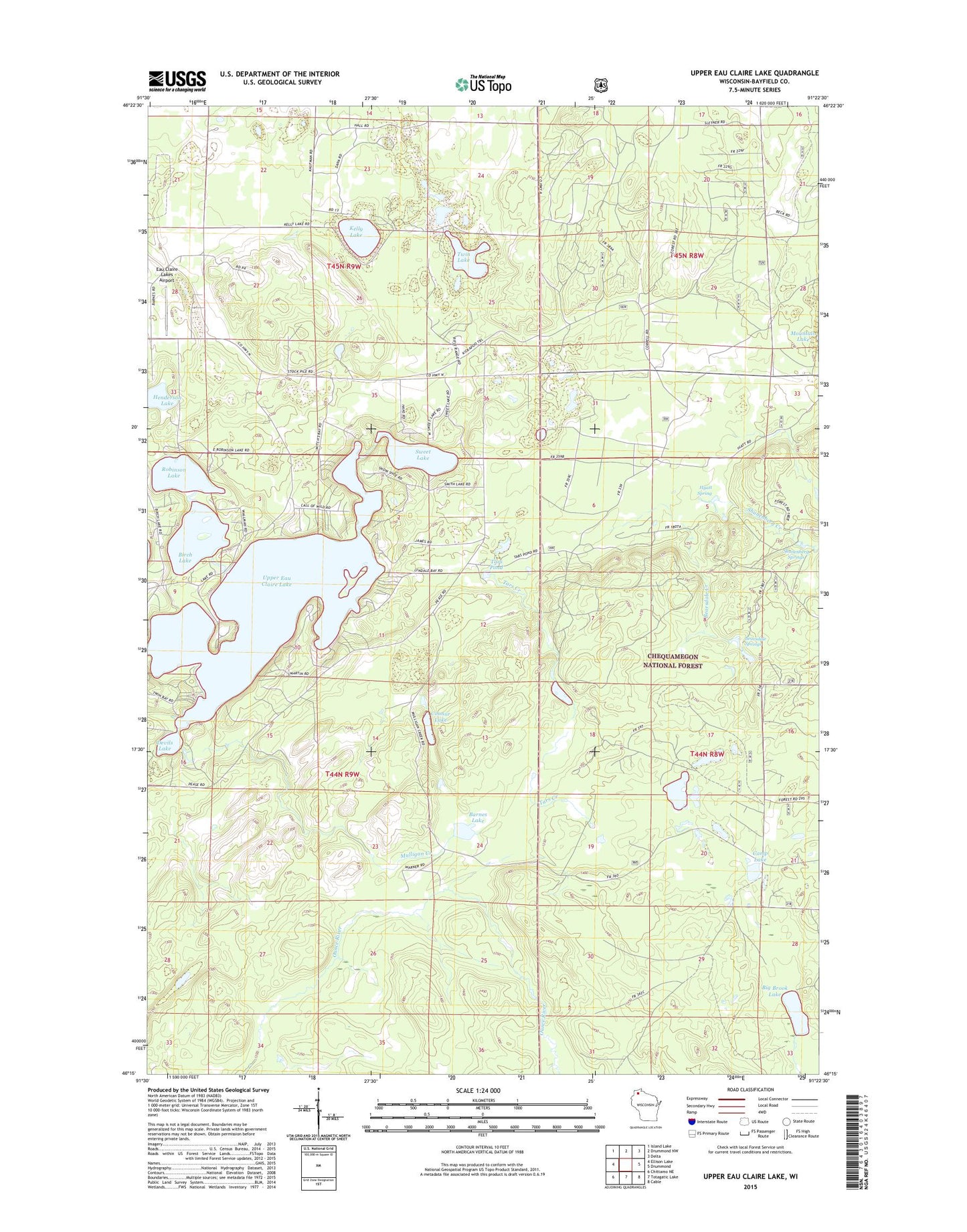
2022 topographic map quadrangle Upper Eau Claire Lake in the state of Wisconsin. Scale: 1:24000. Based on the newly updated USGS 7.5' US Topo map series, this map is in the following counties: Bayfield. The map contains contour data, water features, and other items you are used to seeing on USGS maps, but also has updated roads and other features. This is the next generation of topographic maps. Printed on high-quality waterproof paper with UV fade-resistant inks.
Quads adjacent to this one:
West: Ellison Lake
Northwest: Island Lake
North: Drummond NW
Northeast: Delta
East: Drummond
Southeast: Cable
South: Totagatic Lake
Southwest: Chittamo NE
This map covers the same area as the classic USGS quad with code o46091c4.
Contains the following named places: Barnes Lake, Barnes School, Bearsdale Creek, Bearsdale Springs, Bearsdale Springs Red Pine Seed Production Area, Big Brook Lake, Birch Lake, Camp Lake, Connor Lake, Devils Lake, Eau Claire Lakes Airport, Hall School, Henderson Lake, Hyatt Spring, Kelly Lake, Mulligan Creek, Pease School, Robinson Lake, Shunenberg Creek, Shunenberg Lake, Shunenberg Springs, Smith Lake, Sweet Lake, Tars Creek, Tars Pond, Town of Barnes, Twin Lake, Upper Eau Claire Lake