MyTopo
Chain Lake Wisconsin US Topo Map
Couldn't load pickup availability
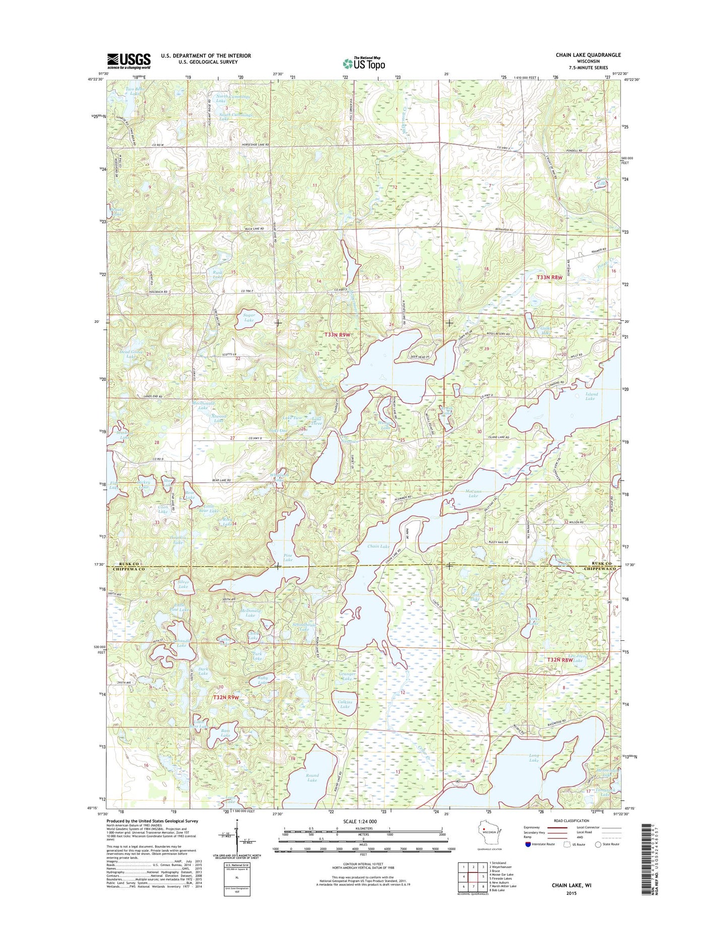
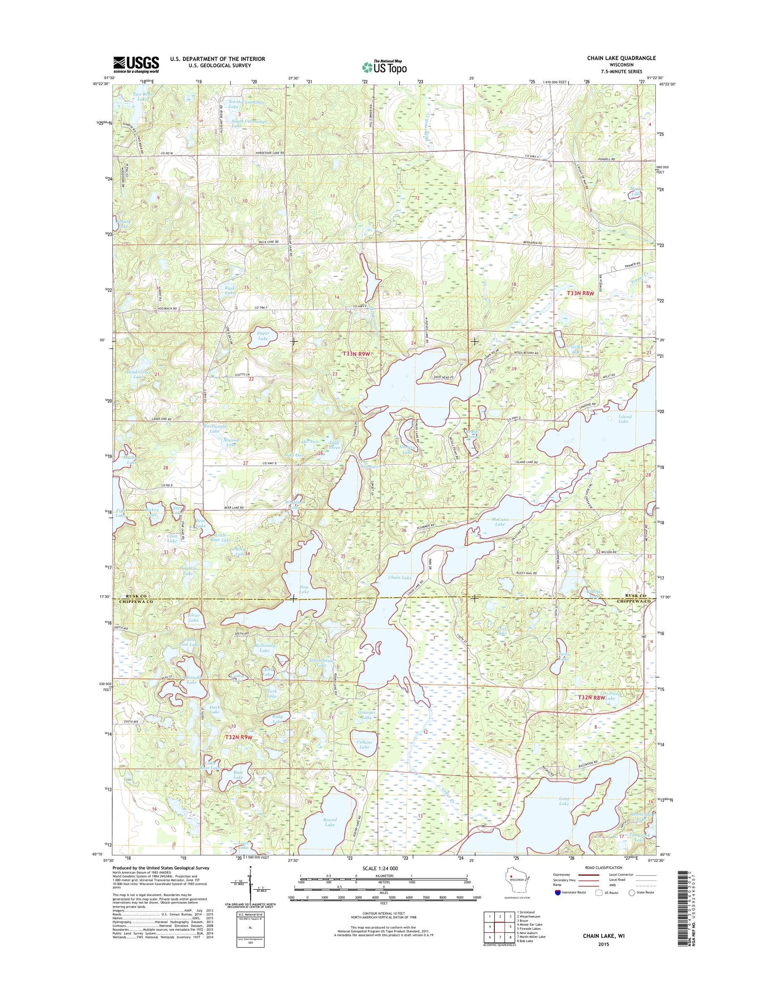
2018 topographic map quadrangle Chain Lake in the state of Wisconsin. Scale: 1:24000. Based on the newly updated USGS 7.5' US Topo map series, this map is in the following counties: Rusk, Chippewa. The map contains contour data, water features, and other items you are used to seeing on USGS maps, but also has updated roads and other features. This is the next generation of topographic maps. Printed on high-quality waterproof paper with UV fade-resistant inks.
Quads adjacent to this one:
West: Moose Ear Lake
Northwest: Strickland
North: Weyerhaeuser
Northeast: Bruce
East: Fireside Lakes
Southeast: Bob Lake
South: Marsh-Miller Lake
Southwest: New Auburn
Contains the following named places: Atwood Lake, Axhandle Lake, Bass Lake, Bear Lake, Bear Lake School, Beauty Lake, Brush Lake, Cadotte Lake, Calkins Lake, Camp Wahdoon, Cather Lake, Cedar Creek, Chain Lake, Chain Lake School, Chick Lake, Clear Lake, Coon Lake, Dark Lake, Dead Goose Lake, Dickey Lake, Galky Lake, Granger Lake, Hogskin Lake, Hungry Lake, Island Lake, Jacks Lake, Lake Four, Lake One, Lake Three, Lake Two, Leo Joerg Lake, Little Bass Lake, Little Bear Lake, Little Pine Lake, Long Lake, Long Lake School, Lost Lake, MacDonald Lake, Mathy Lake, McCann Lake, McDermott Creek, McDonald Lake, Morris-Erickson County Park, Muskrat Lake, North Cummings Lake, North Lima School, Pine Lake, Potato Creek Flowage, Potato Creek State Wildlife Management Area, Potato Lake, Rock Lake, Round Lake, Ruby Lake, Rusk Farm School, Rusk Lake, Rusk Townhall, Schoolhouse Lake, Silver Lake, South Cummings Lake, Stang Lookout Tower, Star Lake, Sugar Lake, Tamarack Lake, The Narrows, Town of Rusk, Turk Lake, Two Bear Camp, Two Bear Lake, Whiplash Lake