MyTopo
Chief Lake Wisconsin US Topo Map
Couldn't load pickup availability
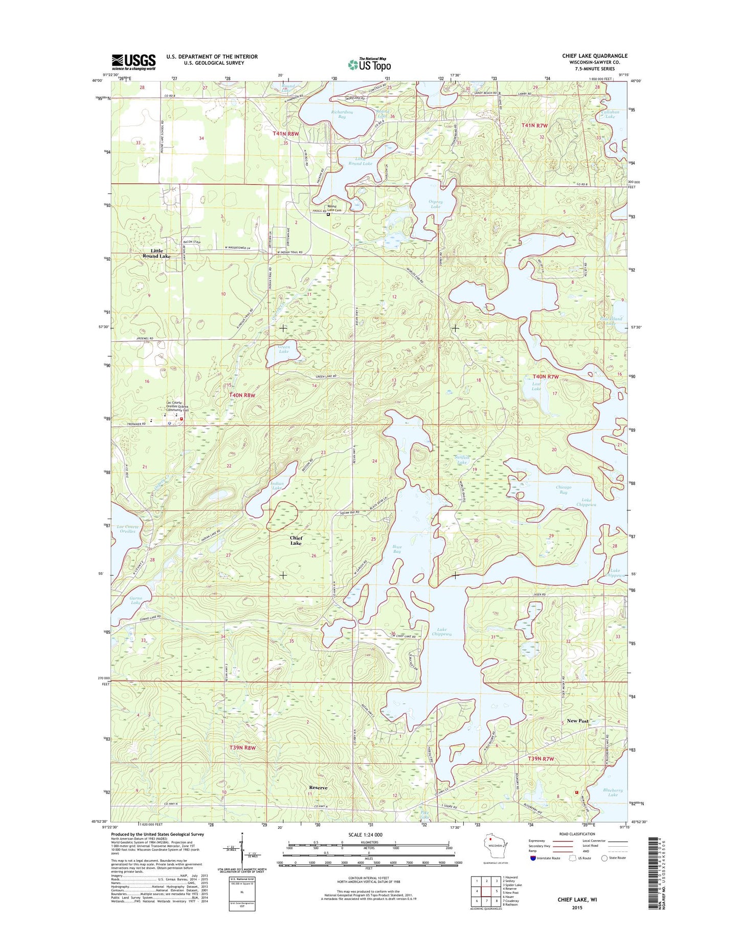
2023 topographic map quadrangle Chief Lake in the state of Wisconsin. Scale: 1:24000. Based on the newly updated USGS 7.5' US Topo map series, this map is in the following counties: Sawyer. The map contains contour data, water features, and other items you are used to seeing on USGS maps, but also has updated roads and other features. This is the next generation of topographic maps. Printed on high-quality waterproof paper with UV fade-resistant inks.
Quads adjacent to this one:
West: Reserve
Northwest: Hayward
North: Seeley
Northeast: Spider Lake
East: New Post
Southeast: Radisson
South: Couderay
Southwest: Hauer
This map covers the same area as the classic USGS quad with code o45091h3.
Contains the following named places: Blueberry Lake, Blueberry Lake Fire Station 13 and Boat Rescue, Chicago Bay, Chief Lake, Chief Lake Census Designated Place, Crane Lake, Green Lake, Gurno Lake, Ikwe Bay, Indian Lake, Lac Courte Oreilles Ojibwa Community College, Lac Courte Oreilles Ojibwa School, Lac Courte Oreilles Reservation, Lac Courte Oreilles Volunteer Fire Department, Little Round Lake, Little Round Lake Census Designated Place, Lost Lake, Osprey Creek, Osprey Lake, Pine Island Lake, Richardson Bay, Round Lake Cemetery, Sunfish Lake, Tyner Lake, Waadookodaading Charter School