MyTopo
City Point Wisconsin US Topo Map
Couldn't load pickup availability
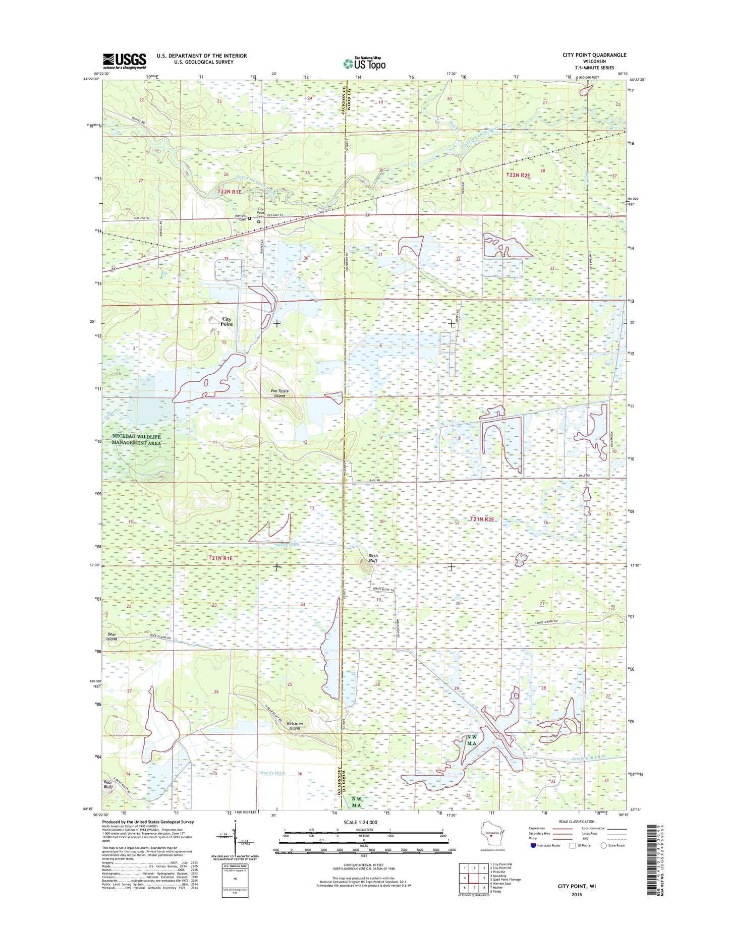
2022 topographic map quadrangle City Point in the state of Wisconsin. Scale: 1:24000. Based on the newly updated USGS 7.5' US Topo map series, this map is in the following counties: Wood, Jackson. The map contains contour data, water features, and other items you are used to seeing on USGS maps, but also has updated roads and other features. This is the next generation of topographic maps. Printed on high-quality waterproof paper with UV fade-resistant inks.
Quads adjacent to this one:
West: Spaulding
Northwest: City Point NW
North: City Point NE
Northeast: Pittsville
East: Quail Point Flowage
Southeast: Finley
South: Mather
Southwest: Warrens East
This map covers the same area as the classic USGS quad with code o44090c3.
Contains the following named places: 20 Reservoir, 54641, Beaver Creek 11 Dam, Birch Bluff, Bissig Ditch, City Point, City Point Catholic Cemetery, City Point Cemetery, Deer Island, Hay Creek, Hay Creek Ditch, Indian Creek, Kert Creek 2 C-6118 Dam, Kert Creek 3 C 6118 Dam, Ketchum Island, Kurt Creek, Lake 10-6, Lake 28-11 8, Lake 29-8 9, Lake 30-7, Lake 3-1 16, Meadow Valley State Wildlife Management Area, Remington 16 C 6118 Dam, Remington 5 C 6118 Dam, Remington 9 C 6118 Dam, Remington Ditch, Skunk Creek, Turner Creek, Van Tassle Island, Weisner Ditch