MyTopo
Spaulding Wisconsin US Topo Map
Couldn't load pickup availability
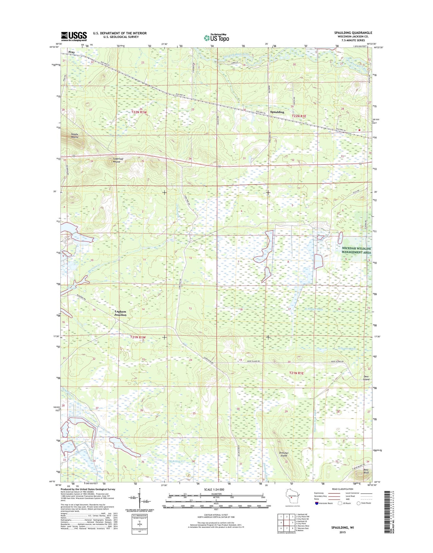
2022 topographic map quadrangle Spaulding in the state of Wisconsin. Scale: 1:24000. Based on the newly updated USGS 7.5' US Topo map series, this map is in the following counties: Jackson. The map contains contour data, water features, and other items you are used to seeing on USGS maps, but also has updated roads and other features. This is the next generation of topographic maps. Printed on high-quality waterproof paper with UV fade-resistant inks.
Quads adjacent to this one:
West: Hatfield SE
Northwest: Hatfield NE
North: City Point NW
Northeast: City Point NE
East: City Point
Southeast: Mather
South: Warrens East
Southwest: Warrens West
This map covers the same area as the classic USGS quad with code o44090c4.
Contains the following named places: Bear Bluff, Borek Cranberry Marsh, City Point Volunteer Fire Department, Cranberry Marsh Reservoir 2WP1503 Dam, Davidson Creek, Drescher Island, Eleva Station, Lapham Junction, North Floater Ditch, Pergande Cranberry Marsh, Pray, South Floater Ditch, Spaulding, Sugarloaf Mound, Town of City Point