MyTopo
Clintonville South Wisconsin US Topo Map
Couldn't load pickup availability
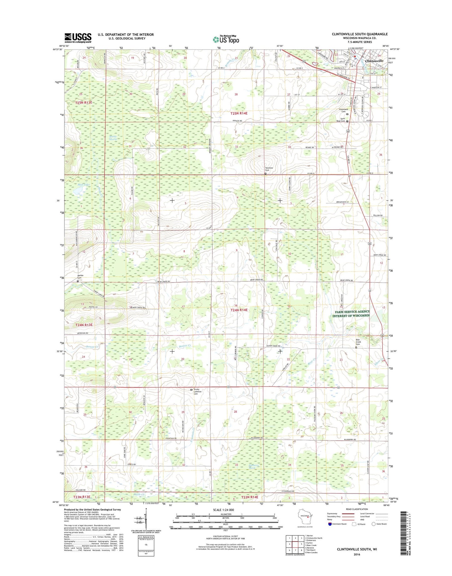
2018 topographic map quadrangle Clintonville South in the state of Wisconsin. Scale: 1:24000. Based on the newly updated USGS 7.5' US Topo map series, this map is in the following counties: Waupaca. The map contains contour data, water features, and other items you are used to seeing on USGS maps, but also has updated roads and other features. This is the next generation of topographic maps. Printed on high-quality waterproof paper with UV fade-resistant inks.
Quads adjacent to this one:
West: Symco
Northwest: Marion
North: Clintonville North
Northeast: Embarrass
East: Bear Creek
Southeast: New London
South: Northport
Southwest: Manawa
Contains the following named places: Bear Creek Cemetery, Bell Corner School, Blueberry Marsh, Bucholtz Park, Canary, City of Clintonville, Clintonville, Clintonville 2WP268 Dam, Clintonville Area Ambulance Service, Clintonville Community Hospital Heliport, Clintonville Fire Department, Clintonville Police Department, Clintonville Post Office, Elm Dale School, Fawn Creek School, Fountain Creek, Fox Valley Technical College Clintonville Regional Center, Graceland Cemetery, Hillside School, Longfellow Elementary School, Maple Grove Farm, Marble, Marble Cemetery, Marble School, Marble Swamp, Mud Lake, Nicholson, Nicholson School, Olen Park, Saint Martin Lutheran School, Saint Rose and Saint Mary School, Saint Rose Cemetery, Saint Rose Saint Mary Catholic School, Silver Creek School, Tellock's Hill Woods State Natural Area, Town of Bear Creek, Townline Cemetery, Trinity Lutheran Cemetery, Trinity Lutheran Church, Trinity Lutheran School, ZIP Code: 54922