MyTopo
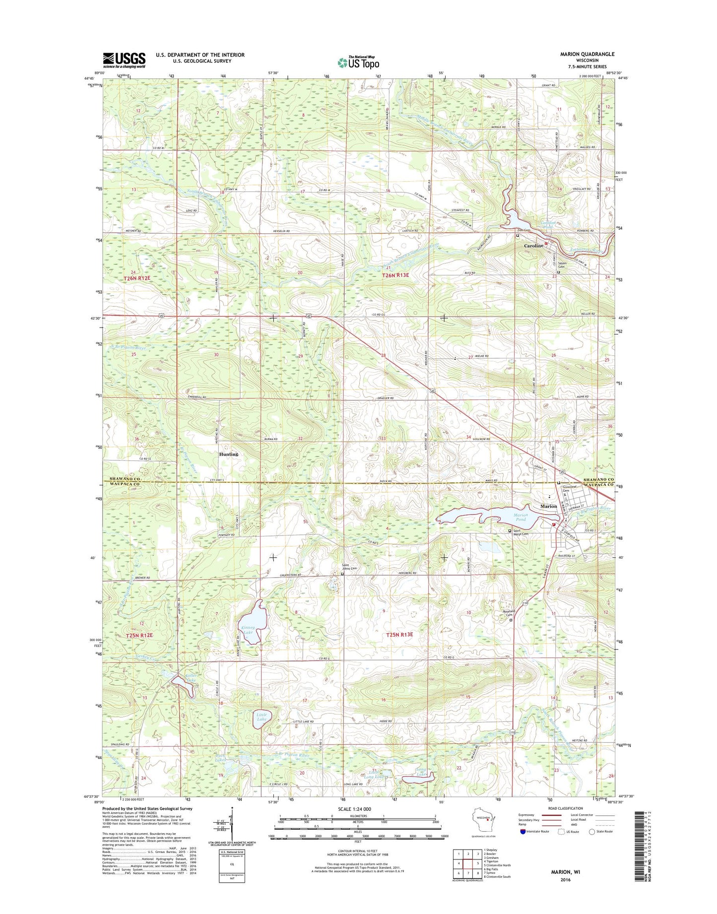
Marion Wisconsin US Topo Map
Couldn't load pickup availability
2022 topographic map quadrangle Marion in the state of Wisconsin. Scale: 1:24000. Based on the newly updated USGS 7.5' US Topo map series, this map is in the following counties: Shawano, Waupaca. The map contains contour data, water features, and other items you are used to seeing on USGS maps, but also has updated roads and other features. This is the next generation of topographic maps. Printed on high-quality waterproof paper with UV fade-resistant inks.
Quads adjacent to this one:
West: Tigerton
Northwest: Shepley
North: Bowler
Northeast: Gresham
East: Clintonville North
Southeast: Clintonville South
South: Symco
Southwest: Big Falls
This map covers the same area as the classic USGS quad with code o44088f8.
Contains the following named places: Buck Lakes, Caroline, Caroline 1885c282 Dam, Caroline Census Designated Place, Caroline Pond 247, Caroline Post Office, City of Marion, Clintonville Area Ambulance Service, Geskey Creek, Granite City, Grant Fire Department, Greenleaf Cemetery, Hunting, Keller C5602.6 Dam, Keller Lake, Kinney Lake, Leuthold Granite Quarry, Little Lake, Little Long Lake, Long Lake, Maple Valley School, Marion, Marion 2WP732 Dam, Marion Elementary School, Marion Junior / Senior High School, Marion Police Department, Marion Pond, Marion Post Office, Marion Sewage Treatment Plant, Marion Volunteer Fire Department, Methodist Cemetery, Middle Branch Embarrass River, Mielke School, Roseland Cemetery, Saint Johns Cemetery, Saint Johns Lutheran Church, Saint Mary Cemetery, Saint Marys Catholic Church, South Branch Embarrass River, Sunrise School, Town of Dupont, Town of Grant, Wallace Park, Zion Cemetery, ZIP Code: 54950