MyTopo
Symco Wisconsin US Topo Map
Couldn't load pickup availability
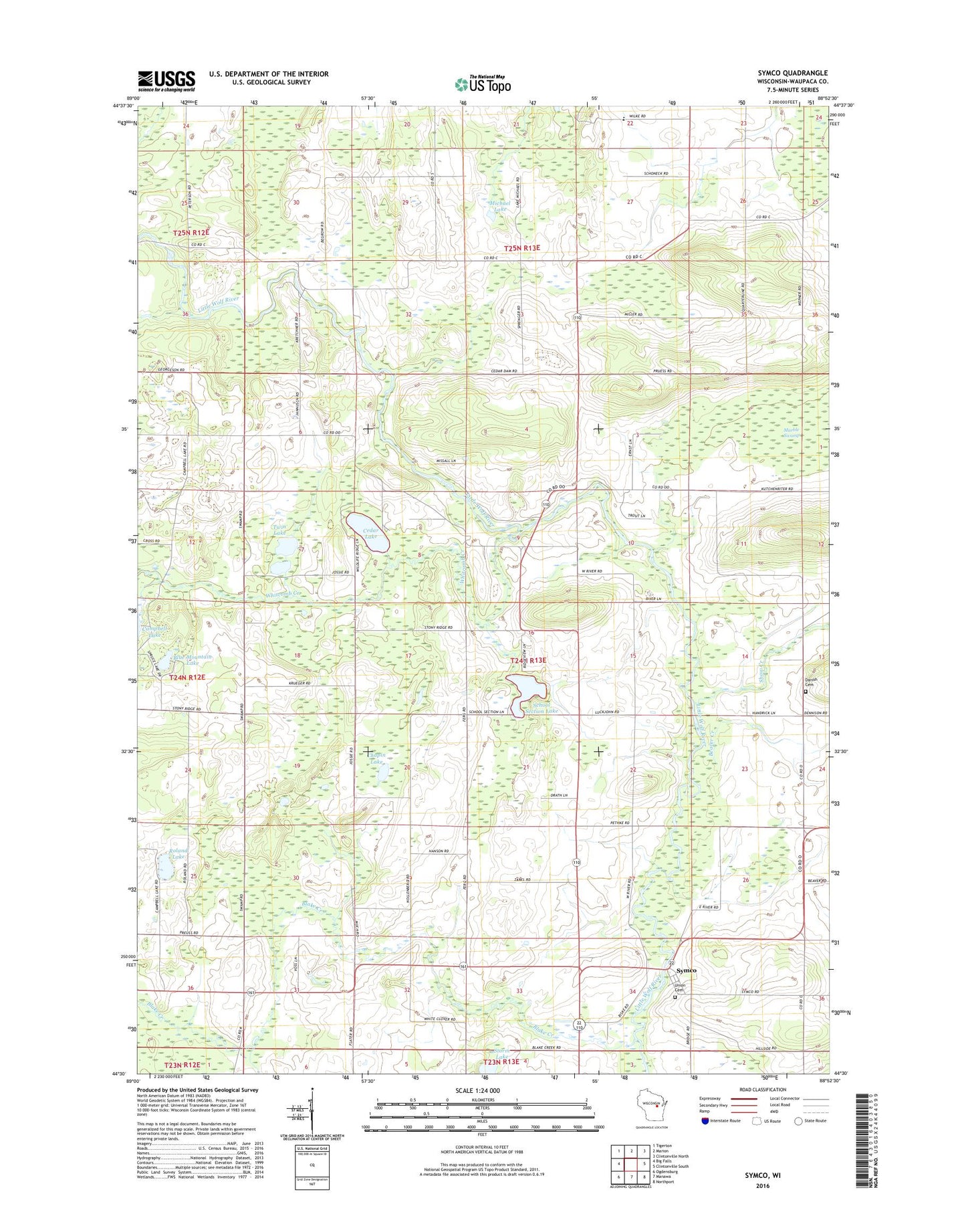
2022 topographic map quadrangle Symco in the state of Wisconsin. Scale: 1:24000. Based on the newly updated USGS 7.5' US Topo map series, this map is in the following counties: Waupaca. The map contains contour data, water features, and other items you are used to seeing on USGS maps, but also has updated roads and other features. This is the next generation of topographic maps. Printed on high-quality waterproof paper with UV fade-resistant inks.
Quads adjacent to this one:
West: Big Falls
Northwest: Tigerton
North: Marion
Northeast: Clintonville North
East: Clintonville South
Southeast: Northport
South: Manawa
Southwest: Ogdensburg
This map covers the same area as the classic USGS quad with code o44088e8.
Contains the following named places: Beaver Creek, Blake Creek, Blue Mountain Lake, Cedar Lake, Chapin Lake, Danish Cemetery, Dellwood School, Dupont, Fairfield School, Helvetia, Knowledge Hill School, Lake Michael School, Little Mountain School, Michael Lake, Pioneer School, Pleasant View Amish School, Roland Lake, Saint Pauls Church, School Number 2, School Section Lake, Shady Grove School, Shaw Creek, State Road School, Storm Lake, Symco, Town of Union, Twin Lake, Union Cemetery, Whitcomb Creek