MyTopo
Manawa Wisconsin US Topo Map
Couldn't load pickup availability
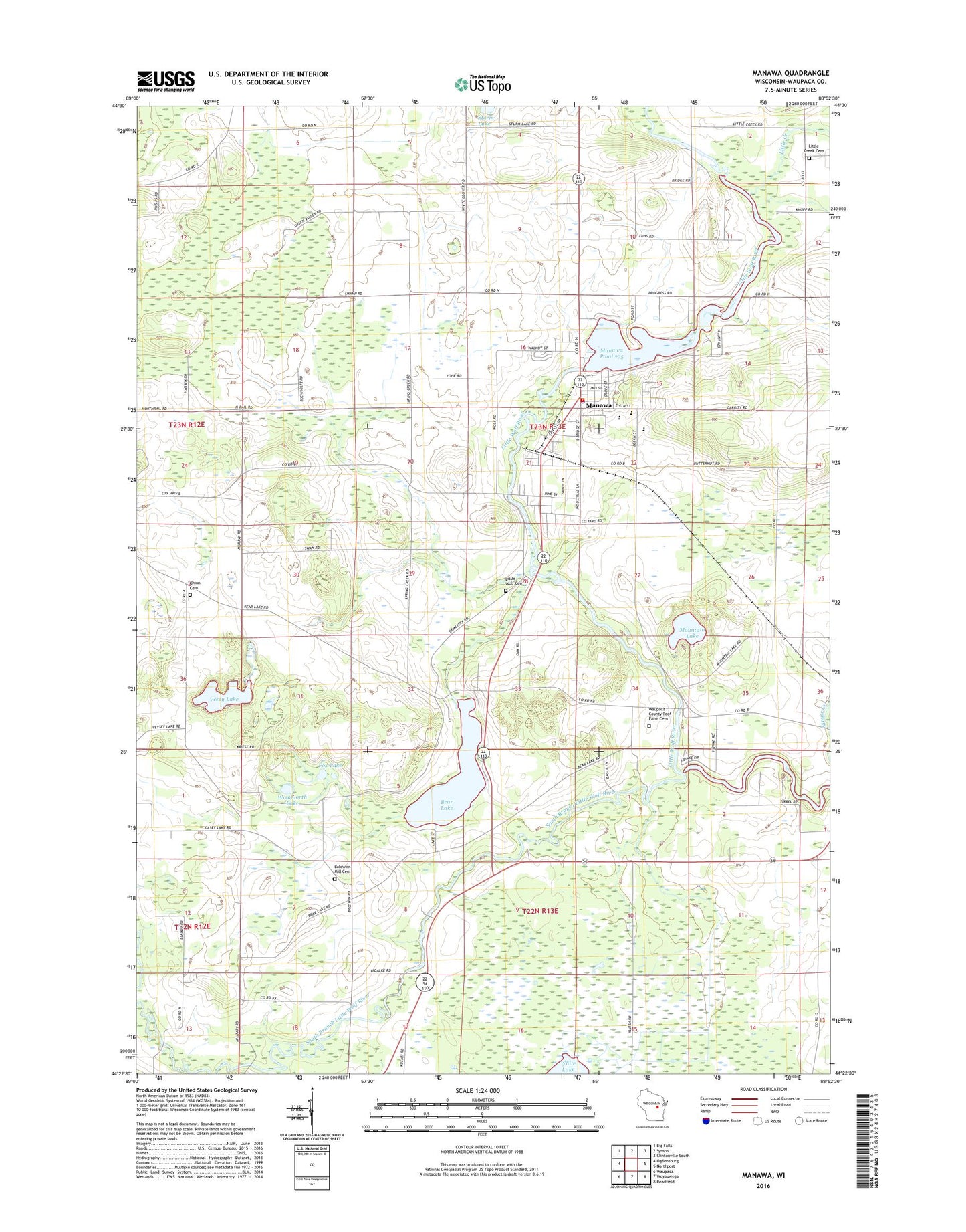
2022 topographic map quadrangle Manawa in the state of Wisconsin. Scale: 1:24000. Based on the newly updated USGS 7.5' US Topo map series, this map is in the following counties: Waupaca. The map contains contour data, water features, and other items you are used to seeing on USGS maps, but also has updated roads and other features. This is the next generation of topographic maps. Printed on high-quality waterproof paper with UV fade-resistant inks.
Quads adjacent to this one:
West: Ogdensburg
Northwest: Big Falls
North: Symco
Northeast: Clintonville South
East: Northport
Southeast: Readfield
South: Weyauwega
Southwest: Waupaca
This map covers the same area as the classic USGS quad with code o44088d8.
Contains the following named places: Baldwins Mill, Baldwins Mill Cemetery, Baldwins Mill School, Bear Lake, Block Cemetery, Block School, City of Manawa, Fox Lake, Green Valley School, Little Creek, Little Creek Cemetery, Little Creek School, Little Wolf, Little Wolf Cemetery, Little Wolf Junior / Senior High School, Little Wolf-Royalton School, Manawa, Manawa 1899C177 Dam, Manawa Elementary School, Manawa Police Department, Manawa Pond 275, Manawa Post Office, Manawa Rural Ambulance, Manawa Rural Fire and Ambulance Department, Manawa Wastewater Treatment Facility, Maple Grove School, Mountain Lake, Sacred Hearth Catholic Church, Saint John Church, Saint Paul Lutheran Church, Saint Paul's Lutheran School, South Branch Little Wolf River, Spring Brook School, Sturms Hill School, Town of Little Wolf, Vesey Lake, Waupaca County, Waupaca County Home, Waupaca County Poor Farm Cemetery, Waupace County Park, Woodnorth Lake, Zion Lutheran Church, ZIP Code: 54949