MyTopo
Reeseville Wisconsin US Topo Map
Couldn't load pickup availability
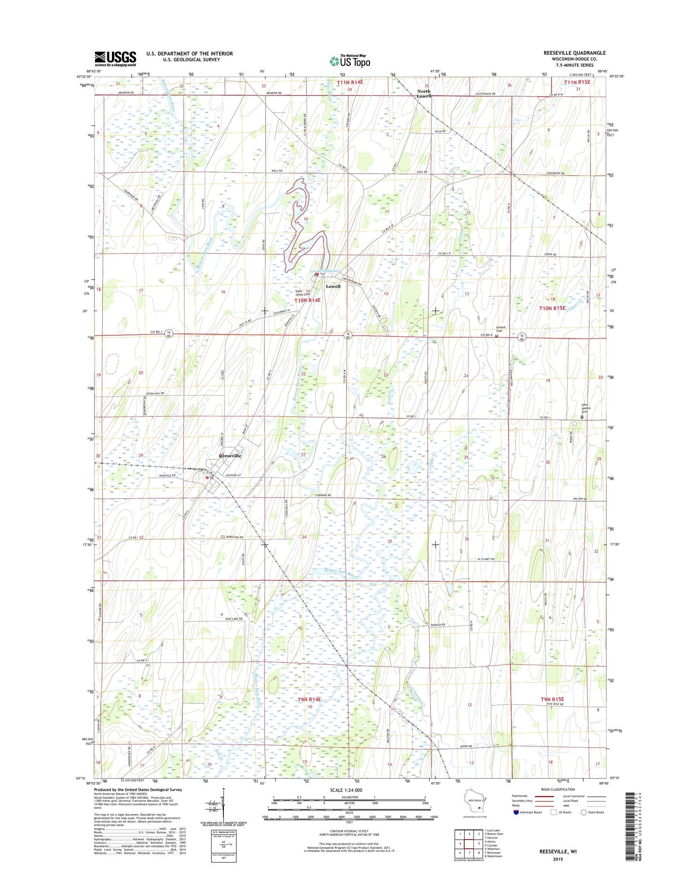
2022 topographic map quadrangle Reeseville in the state of Wisconsin. Scale: 1:24000. Based on the newly updated USGS 7.5' US Topo map series, this map is in the following counties: Dodge. The map contains contour data, water features, and other items you are used to seeing on USGS maps, but also has updated roads and other features. This is the next generation of topographic maps. Printed on high-quality waterproof paper with UV fade-resistant inks.
Quads adjacent to this one:
West: Astico
Northwest: Lost Lake
North: Beaver Dam
Northeast: Horicon
East: Clyman
Southeast: Watertown
South: Richwood
Southwest: Waterloo
This map covers the same area as the classic USGS quad with code o43088c7.
Contains the following named places: Brookside Farms, Casper Creek, Cold Spring Creek, Dodgeland Junior High School, Dodgeland Middle School, East Lowell School, F and D Farms, Firemens Park, Gahlman School, Kohn Century Farms, Lau Creek, Lowell, Lowell Dam, Lowell Elementary School, Lowell Fire Department, Lowell Millpond, Lowell Police Department, Lowell Post Office, Methodist Cemetery, North Lowell, North Star School, Pleasant Hill School, Pratt Creek, Reeseville, Reeseville Fire Department, Reeseville Police Department, Reeseville Post Office, Reeseville Public Library, Saint Isador Cemetery, Saint Johns Catholic Cemetery, Shaw Brook, Town of Lowell, Village of Lowell, Village of Reeseville, ZIP Codes: 53557, 53579