
MyTopo
Coleman Lake Wisconsin US Topo Map
Couldn't load pickup availability
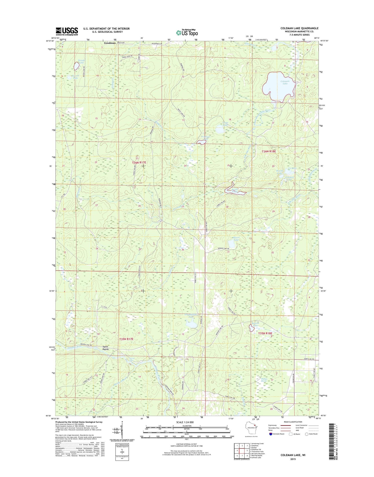
2018 topographic map quadrangle Coleman Lake in the state of Wisconsin. Scale: 1:24000. Based on the newly updated USGS 7.5' US Topo map series, this map is in the following counties: Marinette. The map contains contour data, water features, and other items you are used to seeing on USGS maps, but also has updated roads and other features. This is the next generation of topographic maps. Printed on high-quality waterproof paper with UV fade-resistant inks.
Quads adjacent to this one:
West: Goodman SW
Northwest: Armstrong Creek
North: Goodman
Northeast: Dunbar
East: Twelvefoot Falls
Southeast: Lehman Lake
South: Roaring Rapids
Southwest: McCaslin Mountain
Contains the following named places: Avery Creek, Benson Lake, Brock G1536.2 Dam, Brock Pond, Brock Pond 34, Camp F Creek, Chemical Creek, Coleman Lake, Crooked Lake, D'Amour Lake, Goodman Census Designated Place, Goodman County Park, Goodman Lookout Tower, Grandfather Lake, Harvey Creek, Little Harvey Creek, Mirror Lake, Phillips Marsh, Round Lake, Second Lake, Strong Falls, Swede John Creek, Taylor Rapids, Trout Lake, Vic Lake, Windsor Dam, Woods Lake


