MyTopo
Goodman Wisconsin US Topo Map
Couldn't load pickup availability
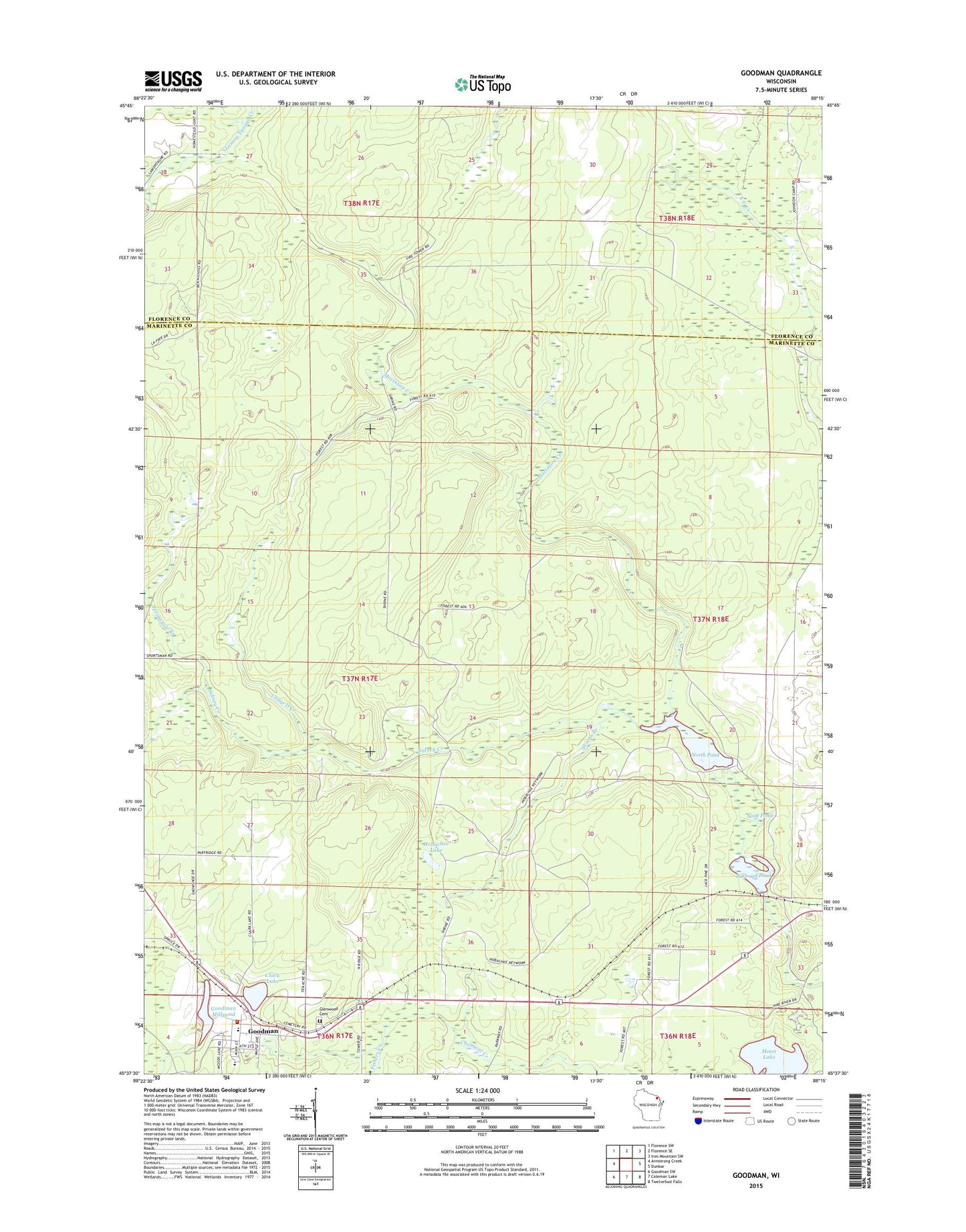
2022 topographic map quadrangle Goodman in the state of Wisconsin. Scale: 1:24000. Based on the newly updated USGS 7.5' US Topo map series, this map is in the following counties: Marinette, Florence. The map contains contour data, water features, and other items you are used to seeing on USGS maps, but also has updated roads and other features. This is the next generation of topographic maps. Printed on high-quality waterproof paper with UV fade-resistant inks.
Quads adjacent to this one:
West: Armstrong Creek
Northwest: Florence SW
North: Florence SE
Northeast: Iron Mountain SW
East: Dunbar
Southeast: Twelvefoot Falls
South: Coleman Lake
Southwest: Goodman SW
This map covers the same area as the classic USGS quad with code o45088f3.
Contains the following named places: Camp D Creek, Clark Lake, Dunbar Barrens State Natural Area, Fishers Creek, Glenwood Cemetery, Goodman, Goodman - Armstrong Elementary School, Goodman - Armstrong High School, Goodman - Armstrong Rescue Squad, Goodman Dam, Goodman Millpond, Goodman Post Office, Goodman Volunteer Fire Department, Hatchery Dam, Hobachee Lake, Kirton Dam, Lost Lake, Macintire Creek, Middle Dam, Moon Lake, North Pond, North Pond 20, Railroad Pond, Scott Dam, Scott Pond 30, Shinns Branch, Sidney Creek, Springdale Branch, Town of Goodman